The first round of rain tonight doesn’t look as impressive as it did in previous days.
Right now, the Northland is sandwiched between two areas of rain—one to the east and the other to the west. The rain over the eastern Dakotas is moving east-northeast and could pass through parts of the Northland late tonight or early Monday morning, but it’s expected to be lighter than what recent model guidance had been indicating.
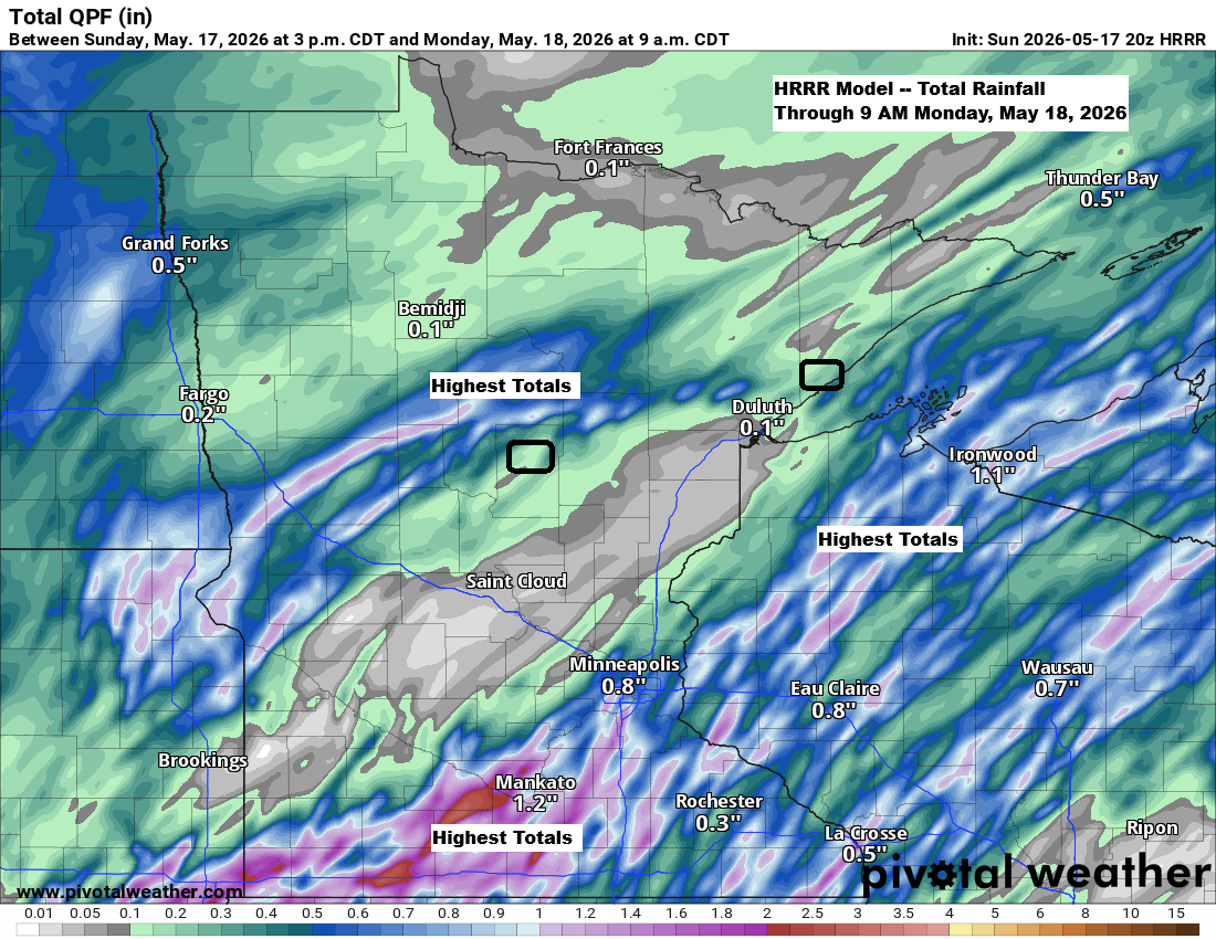
By 8 AM Monday, rainfall in Duluth could range from just a trace to about 0.10 inches.
Radar loop ends 4:32 PM CT Sunday, May 17, 2026.
As of Sunday afternoon, May 17, 2026, the Flanders Fire has expanded to roughly 2,000 acres (2,093.6 acres).
…Flanders Fire…

Rain totals near and over this fire for tonight are lower than earlier forecasts, as shown below.
The HRRR model from Sunday afternoon indicates rainfall in and around the fire zone ranging from about 0.03 to 0.11 inches through 8 AM Monday.

…Stewart Trail Fire…
As of Sunday afternoon, May 17, 2026, the Stewart Trail Fire had burned 354.6 acres and was 30% contained.

Evacuation zones updated as of Sunday afternoon, May 17.
The following zones have been downgraded from go to ready.
- Flood Bay
- East Silver Creek
- Fors
- South Castle Danger
- Central Castle Danger

Rainfall in and around the Stewart Trail Fire area could total about 0.10 inches by 8 a.m. Monday.

…Winds and additional rain chances…
Strong northeast winds of 25 to 45 mph will persist near Lake Superior and Duluth tonight. Winds will ease on Monday before picking up again from the northeast Monday night, with gusts of 15 to 30 mph. By Tuesday, winds will shift to the northwest, still bringing gusts of 15 to 30 mph.
There’s a chance of more rain in northeast Minnesota and northwest Wisconsin from Monday evening into Tuesday morning, though the exact amounts are still uncertain.
Leave a Reply