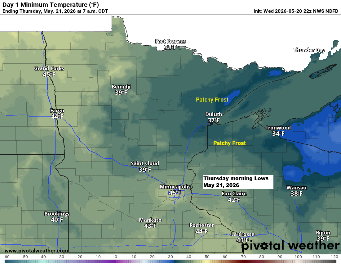
Patchy frost could make another appearance in parts of northeast Minnesota and northwest Wisconsin early Thursday morning, with temperatures dipping to around 32 degrees.
Record Lows for May 21
International Falls, MN: 21 set in 1924
Hibbing, MN: 24 set in 2006
Ashland, WI: 27 set in 1986 and 2002
Duluth, MN: 28 set in 1971
Brainerd, MN: 29 set in 1917

It wasn’t quite record cold in parts of the Northland on Wednesday morning, but it was definitely chilly for May 20th.
Several spots in east-central and northern Minnesota dipped several degrees below freezing Wednesday morning, including 26 in Pine River, 28 in Longville, Brainerd, Aitkin, Hibbing, and the Grand Marais Airport, and 29 in International Falls. That’s about 10 to 15 degrees colder than normal for this time of year.
In Brainerd, the average date for temperatures falling to 28 degrees or below is May 4, with the latest recorded occurrence on June 20 back in 1917. So this morning’s low of 28 degrees on May 20 is about two weeks later than normal.

The next few days will stay dry in the Northland, but rain could return Friday night and Saturday as a system moves northeast through the Upper Midwest. For now, it looks like most of the heavier rain will stay west of us, with much lighter amounts expected in our area.
So far in 2026, precipitation in Duluth has been pretty close to normal, coming in at just +0.07 inches above average as of May 20th. However, considering the two prior years—2024 and 2025—were both below normal, when you add those deficits to this year’s slight surplus, we’re still nearly 14 inches below average overall (-13.94 inches).

Here’s a look at the precipitation departure from January 1, 2024, to May 19, 2026.
Green and blue: Above Average
Yellow and orange: Below Average

Leave a Reply