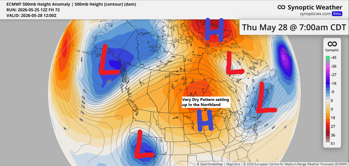
The upcoming weather pattern looks very blocky and amplified, meaning day-to-day changes will be minimal.
Northeast Minnesota and northwest Wisconsin appear to be in the dry zone after tonight, with little to no rain expected at least through early next week.
A cold front is moving south across the Northland tonight, likely bringing widely scattered showers and a few isolated thunderstorms, mainly before midnight, with the greatest impact in far northern Minnesota and the Arrowhead region.
Radar loop ends 5:16 PM Monday, May 25, 2026.
I think the chances of getting any rain in Duluth with the front tonight are pretty low, with slightly better odds for a passing shower north of the city.

AI model data shows a dry spell not just in the Northland, but across much of the upper Midwest and Great Lakes over the next week or so. This setup is shaping into a classic El Niño pattern, with most of the rain hitting parts of the western U.S. and stretching into the central and southern regions, while areas farther north stay much drier.

Temperatures in the Twin Ports varied widely today depending on how close you were to Lake Superior. Farther inland, it reached the 80s this afternoon, while areas near the lake stayed much cooler, ranging from the upper 40s to mid-60s.
At 4 PM in Duluth, temperatures ranged from 87 in Hermantown to 51 on London Road in east Duluth, and down to 48 at Duluth Sky Harbor Airport. Wild swings, but nothing out of the ordinary for late spring.
The official high in Duluth (at the airport) reached 84 degrees today. The record for May 25th is 89, set in 2018. This was the second day this month with a high of at least 80 in Duluth, matching the monthly average of two such days.
Note: Water temperatures in the southwest arm of Lake Superior are only in the mid-30s, which is below the typical late May average of around 40 degrees.

This afternoon’s regional temperatures are showing widespread 80s and even a few spots hitting the low 90s, giving off a definite summer vibe—except near Lake Superior.
On May 25th, International Falls, Minnesota set a new daily record high of 89 degrees, surpassing the previous record of 88 degrees set in 1919.
Hibbing and Ashland came within just one degree of matching their record high for May 25th today.
For the rest of the week, temperatures will show a west-to-east gradient in our area, with the warmest weather out west and cooler conditions near Lake Superior. Inland areas of northeast Minnesota and northwest Wisconsin can expect highs in the 70s and 80s from Tuesday through Saturday, while spots closer to Lake Superior will see cooler highs in the 40s and 50s.

Leave a Reply