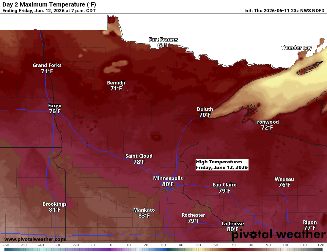
The upper-level flow is shifting back to the northwest and will stick around through at least the middle of next week, bringing a cooler pattern to the Northland. However, areas near Lake Superior along the North Shore will actually feel warmer than in recent weeks, thanks to more frequent offshore winds bringing milder air instead of the colder onshore breezes.
Northeast Minnesota and northwest Wisconsin will see highs in the 60s and 70s on Friday and Saturday, with gusty west winds blowing at 15 to 30 mph and the chance for even stronger gusts.

Rain passed through parts of northwest Wisconsin and far eastern Minnesota today, while scattered showers and a few thunderstorms developed in north central Minnesota this afternoon. A few reports mentioned small hail, around half an inch or less in diameter, along with some gusty winds.
Scattered showers and thunderstorms moving through the Northland this afternoon are expected to wrap up by late tonight.
Radar loop ends 5:56 PM Thursday, June 11, 2026.
Looks like widely scattered showers may redevelop in the Northland late Friday, but coverage should be less than Thursday.
NAM 3km model simulated radar forecast valid 1 PM to 11 PM Friday.

Several disturbances are showing up on the water vapor imagery today, and the pattern is unusually active for this time of year.
Goes-19 water vapor loop ends 5:40 PM CT Thursday, June 11, 2026.

Leave a Reply