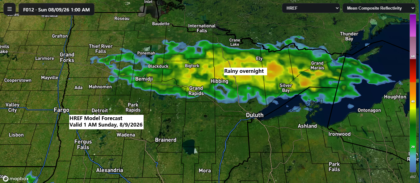
Rain is likely tonight into early Sunday morning in parts of the Northland as a frontal boundary drifts southeast through the region. With limited instability, a few isolated thunderstorms are possible but expect mostly rain showers and little thunderstorm activity.
The rain should clear out to the east by mid-morning Sunday, leaving mostly dry conditions for the rest of the day.
HRRR model simulated radar forecast through 9 AM Sunday.
Tonight’s front will bring the heaviest rainfall north of Duluth, with amounts ranging from 0.20 to 0.60 inches. Farther south, including Duluth, eastern Minnesota, and northwest Wisconsin, totals will generally be lighter, mostly under 0.1 inches.

If you’d like to donate, you’re welcome to do so below.
Make a one-time donation
Make a monthly donation
Make a yearly donation
Choose an amount
Or enter a custom amount
Your contribution is appreciated.
Your contribution is appreciated.
Your contribution is appreciated.
Wildfire smoke will linger across the Northland through at least Monday afternoon, but most of it will stay higher in the atmosphere. This will bring hazy skies, though little to no smoke is expected at ground level.
HRRR model vertically integrated smoke forecast through 1 PM Monday.
Leave a Reply