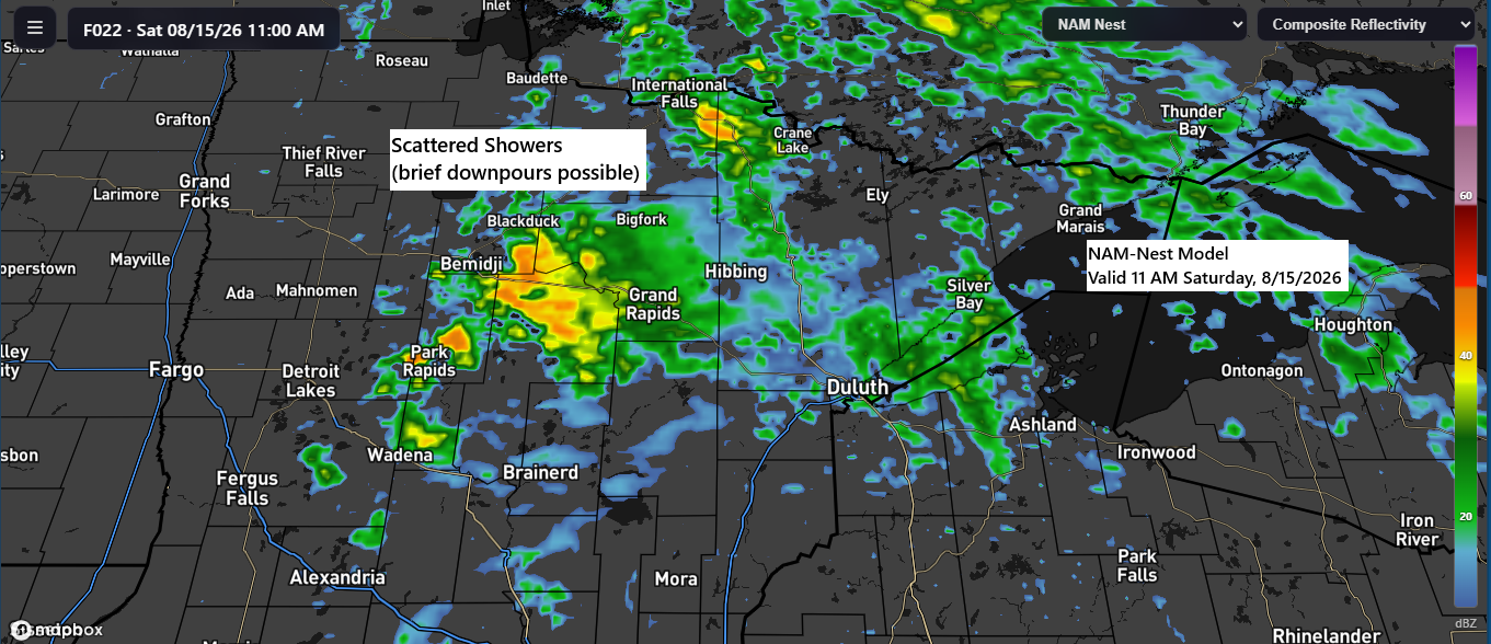
The well-advertised system expected on Saturday is still on track to bring rain showers to northeast Minnesota and northwest Wisconsin. With precipitable water values ranging from 1.4 to 1.9 inches and dew points climbing into the 60s and near 70 degrees, parts of the Northland could see locally heavy downpours.
A few thunderstorms may occur on Saturday, but they are expected to remain isolated due to extensive cloud cover, which will limit heating and atmospheric instability, and no severe weather is anticipated.
Rain chances decrease across the Northland Saturday night, resulting in mostly dry conditions on Sunday.
With clouds and scattered rain expected on Saturday, temperatures in northeast Minnesota will remain cool for mid-August, mostly in the 60, with east winds persisting near Lake Superior. Warmer conditions are forecast farther west and south, reaching the 70s and 80s by Saturday afternoon.

Forecast models now indicate that this system may bring slightly more rain than previously projected. Although the exact amounts remain uncertain, current trends suggest somewhat higher rainfall totals on Saturday.
Rainfall totals of 0.1 to 0.25 inches are expected to be common across the Northland on Saturday, with north-central Minnesota potentially receiving 0.5 inches or more.
Note: In the Duluth area, rain totals may reach around 0.25 inches by Saturday evening, with the likelihood of receiving up to a quarter inch of rain slightly higher than it appeared over the past few days.
HREF model’s total rainfall forecast through midnight Sunday.

Blend of Models total rainfall forecast through midnight Sunday.

NAM-Nest model simulated radar forecast through 12 AM Sunday.
If you’d like to donate, you’re welcome to do so below.
Make a one-time donation
Make a monthly donation
Make a yearly donation
Choose an amount
Or enter a custom amount
Your contribution is appreciated.
Your contribution is appreciated.
Your contribution is appreciated.
Rainfall Anomalies for August 2026 up to 4 PM on the 14th
- Brainerd, MN: -1.42″
- Duluth, MN: -1.38″
- Ashland, WI: -1.25″
- Hibbing, MN: -0.74″
- International Falls, MN: +0.28″
Areas highlighted in orange and red on the map below have received far below-average rainfall this month, with totals ranging from just 2% to 20% of normal, whereas green areas have experienced above-average precipitation.

Leave a Reply