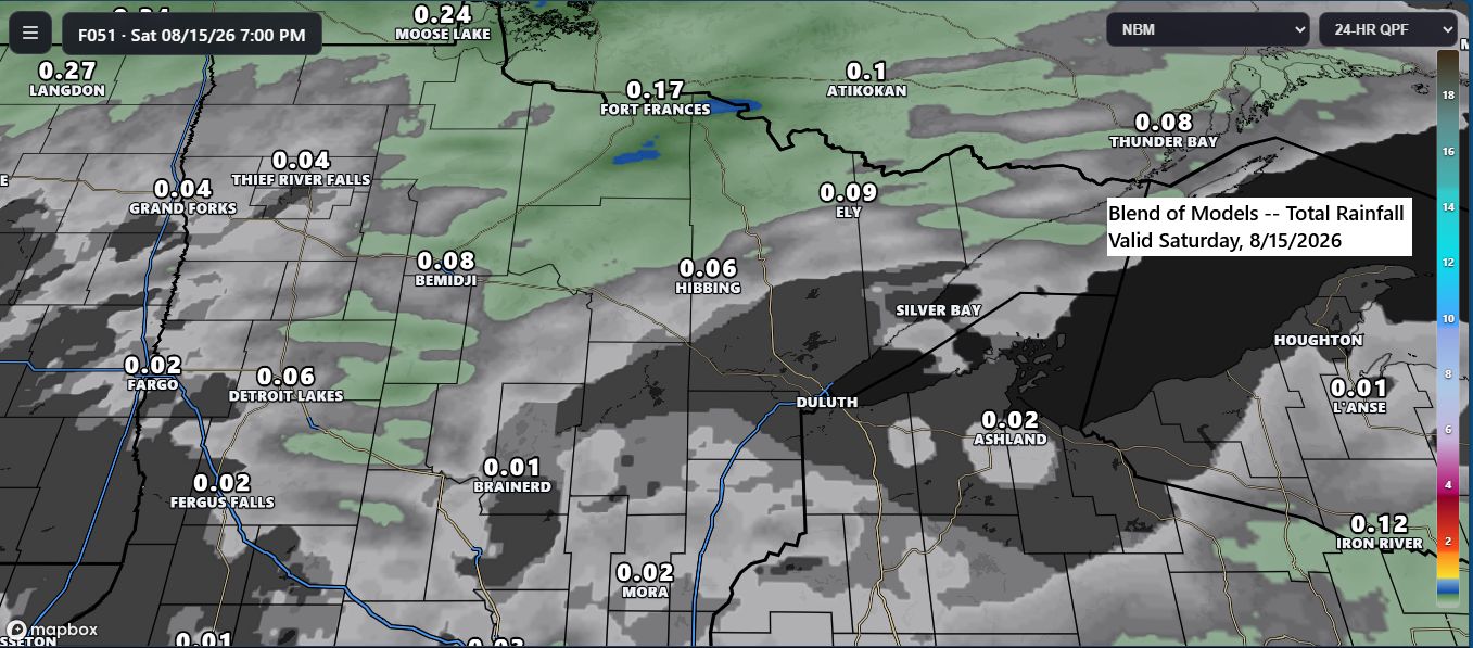
A low-pressure system, along with its warm and cold fronts, will move across the Northland on Saturday, bringing a chance of scattered rain showers. While overall rainfall is expected to be light, and some areas may remain dry, a few showers are still possible throughout the day.
August 4th marked the last time Duluth received at least a quarter inch of rain (0.26″), which was over a week ago. The likelihood of receiving at least a quarter inch of rain on Saturday currently appears quite low.
Precipitation anomalies in Duluth, MN
Since August 1st: -1.26″
Since June 1st: -0.60″
Since January 1st: -1.63″
The larger concern is the precipitation deficit dating back to 2024, with Duluth currently over 15 inches below normal (-15.64″). Significant relief would likely require an unusually heavy rainfall event.
Precipitation departure from January 1, 2024, to August 12, 2026.
Orange/red areas: Below average
Green/blue areas: Above average

NAM Nest model radar forecast valid from 4 AM Saturday through 1 AM Sunday.
If you’d like to donate, you’re welcome to do so below.
Make a one-time donation
Make a monthly donation
Make a yearly donation
Choose an amount
Or enter a custom amount
Your contribution is appreciated.
Your contribution is appreciated.
Your contribution is appreciated.
Leave a Reply