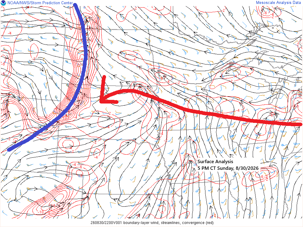
Tonight, a warm front will advance east-northeast from southern Minnesota, while a cold front from the western Dakotas moves eastward. By Monday afternoon, the entire system is expected to have moved northeast of the Northland.
Scattered showers have tracked east across parts of the Northland today, remaining brief and producing only light rainfall, typically a trace to around 0.05 inches. These showers have stayed well north of the warm front positioned over southern Minnesota.
Radar loop from 5:24 AM to 5:23 PM Sunday, August 30, 2026.
Rainfall Report for August 30, 2026, Updated at 5 PM
- Saginaw, MN: 0.05″
- Hermantown, MN: 0.05″
- Duluth Airport: 0.04″
- Meadowlands, MN: 0.04″
- Burnett, MN: 0.04″
- Hill City, MN: 0.03″
- Duluth Sky Harbor Airport: 0.02″
- Floodwood, MN: 0.02″
- Esko, MN: 0.02″
- Bayfield, WI: 0.02″
- Willow River, MN: 0.01″
- McGregor, MN: 0.01″
- Pine River, MN: 0.01″
- Grand Rapids, MN: 0.01″
- Brainerd, MN: 0.01″
- Hinckley, MN: 0.01″
- Solon Springs, WI: 0.01″
- Minong, WI: 0.01″
If you’d like to support the blog, that’s great — but simply reading and sharing it is already very much appreciated.
Make a one-time donation
Make a monthly donation
Make a yearly donation
Choose an amount
Or enter a custom amount
Your contribution is appreciated.
Your contribution is appreciated.
Your contribution is appreciated.
Temperatures south of today’s warm front reached the 80s across western and southern Minnesota, with some areas of eastern South Dakota hitting the 90s. Meanwhile, north of the warm front, temperatures ranged from the 60s near Lake Superior to the 70s in northern Minnesota and northwest Wisconsin.
Note: Duluth is expected to experience a warming trend on Monday and Tuesday, with afternoon temperatures reaching 78 to 83 degrees. Monday morning will likely begin with cool, foggy conditions, but a shift to westerly winds by the afternoon should dissipate the fog and usher in warmer weather.

Scattered showers and thunderstorms are expected to develop later this evening and continue overnight, primarily across northern Minnesota. While severe weather is not anticipated, localized heavy downpours are likely in areas affected by these storms. Showers and thunderstorms should move northeastward and clear the region before 8 AM Monday.
Rain is most likely overnight in areas north of the Twin Ports.
HRRR model simulated radar forecast through 7 AM Monday.
Here is the HRRR model’s rainfall forecast through 10 AM on Monday.
Northern Minnesota remains at the highest risk for heavier downpours overnight into early Monday morning, with localized totals potentially reaching 0.5 to 1 inch, while average accumulations are expected to be around a quarter inch or less.

Widespread fog is expected tonight, especially in areas near Lake Superior, with visibility reduced to approximately one mile. Conditions should improve gradually by mid to late Monday morning.

Leave a Reply