Near-record warmth is expected this weekend in northeast Minnesota and northwest Wisconsin.
The following are the record high temperatures that could be challenged in the coming days.
October 10
Ashland, WI: 86 set in 1938
Brainerd, MN: 85 set in 1928
Duluth, MN: 82 set in 1938
Hibbing, MN: 81 set in 1938
International Falls, MN: 80 set in 1955
October 11
International Falls, MN: 88 set in 2015
Hibbing, MN: 87 set in 2015
Ashland, WI: 86 set in 2015
Brainerd, MN: 85 set in 2015
Duluth, MN: 84 set in 2015
A warm front will move north from southern Minnesota tonight, clearing the Northland by Saturday afternoon. While no precipitation is expected with this northward-moving front, some low clouds and patchy drizzle or fog may develop overnight and linger into Saturday morning.
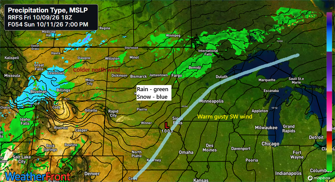
A cold front will then slide south and east out of western Minnesota on Sunday and linger near the region through Monday. A few showers may develop at times along the front from Sunday afternoon through Monday evening, but widespread heavy rainfall appears unlikely at this time.
The Blend of Models rainfall forecast through 7 AM Tuesday shows totals generally around 0.1 inches or less across much of the Northland.

Here’s a look at the forecasted temperatures for Saturday afternoon per HRRR model.
Saturday afternoon should bring widespread temperatures in the low to mid-80s, but near Lake Superior, an easterly wind could stick around much of the day, keeping things in the 50s and 60s. There’s a chance the southerly wind could eventually take over, but that might not happen until later in the afternoon. If it does, expect a quick jump into the 80s near Lake Superior by mid to late afternoon.


Parts of southwestern Minnesota are under an air quality alert for Saturday, as strong southerly winds gusting over 40 mph are expected to kick up blowing dust and lower air quality in the area.

Meanwhile, parts of Montana are under winter weather alerts for accumulating snow this weekend. This snowfall will be caused by the remnants of Tropical Storm Rachel, which will send moisture far north into colder air, leading to snow in sections of the Rockies.

European model total snowfall (10:1 ratio) through 7 AM Monday.

It’s a busy weather pattern across North America, with Hurricane Isaias nearing landfall between Pensacola and Destin, Florida, Tropical Storm Rachel tracking northeast toward Baja California, and a strong storm system spinning over western Canada and the Pacific Northwest.
GOES-East water vapor loop from Friday, October 9, 2026, running from 6:25 AM to 6:15 PM CT.
Leave a Reply