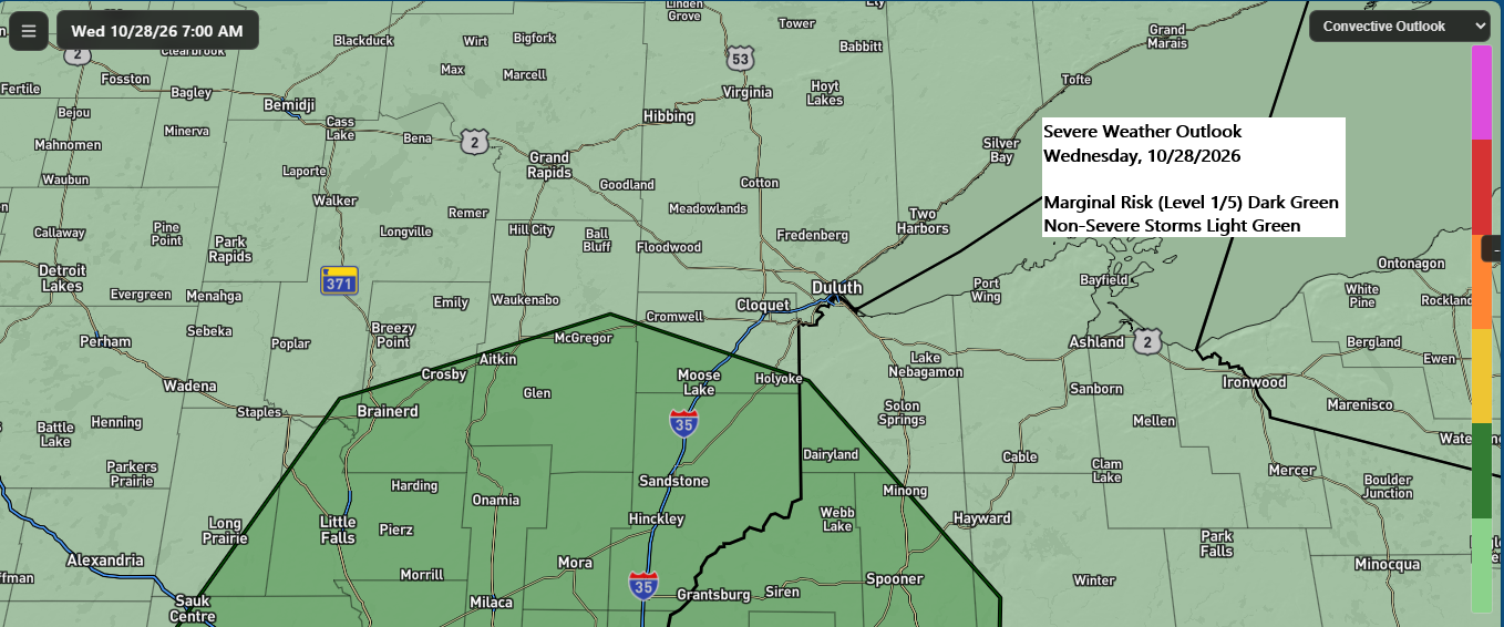
Today’s storm system moved out of the region late this afternoon, but areas of fog and patchy drizzle will linger in its wake tonight. Attention then turns to the next fast-moving weather maker, which is expected to arrive Wednesday afternoon and exit the area by Wednesday night.
On Wednesday, a low-pressure system will move east-northeast from South Dakota, with a warm front lifting north from southern Minnesota and a cold front pushing east from western Minnesota.

With this system moving in on Wednesday, the atmosphere will respond quickly. A strengthening low-level jet from the southwest, reaching speeds of 30-45knots, will carry moisture and warm air northward while boosting instability.
RAP model 850mb forecast for Wednesday afternoon, 10/28/2026.

RAP model most unstable cape for Wednesday afternoon, 10/28/2026.

The overall setup appears fairly favorable for a few strong to severe thunderstorms late Wednesday afternoon, especially considering its late October. Wind speeds aloft will be quite strong, and as mentioned earlier, a robust low-level jet will contribute to significant wind shear across the region. The biggest question mark is instability. Given the time of year, moisture and warmth will be somewhat limited, with afternoon temperatures generally reaching only the 50s to lower 60s across eastern Minnesota and northwest Wisconsin. Dew points are also expected to top out in the 50s. Even so, those ingredients may be sufficient when combined with the strong dynamics of this system to support a few stronger thunderstorms.
RAP model 500mb forecast for Wednesday afternoon, 10/28/2026.

RAP model 700mb forecast for Wednesday afternoon, 10/28/2026.
The lift from various fronts, low pressure, and an upper trough will bring showers and scattered thunderstorms to northeast Minnesota and northwest Wisconsin from Wednesday afternoon through Wednesday evening.

RAP model 850mb temperature forecast for Wednesday afternoon, 10/28/2026.

The main threat from these storms Wednesday afternoon and evening in east central Minnesota and northwest Wisconsin seems to be hail up to quarter size (1″ in diameter). However, a tornado can’t be ruled out if enough instability develops during the afternoon.
Note: Showers and thunderstorms are most likely in the Twin Ports area late Wednesday afternoon through early evening, between about 3 PM and 9 PM.
The NAM-Nest model’s simulated radar forecast is valid from 12 PM on Wednesday until midnight.
Rainfall amounts from Wednesday’s system are expected to range between roughly 0.15 and 0.50 inches in the Northland, with some spots potentially seeing higher totals.

Leave a Reply