Tonight, a warm front will lift north out of southern Minnesota but this front will likely grind to a halt once it reaches the Northland, and that front will then be overtaken by a cold front which tracks eastward out of western Minnesota on Thursday.
A few showers or thunderstorms may pop up near the advancing warm front late tonight, mostly around the Arrowhead and along the Ontario border.
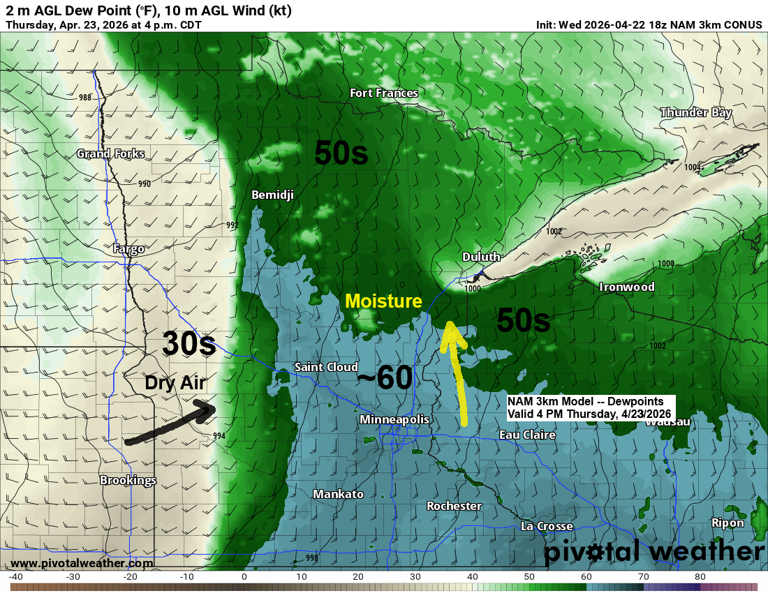
Thursday, as the cold front pushes east into a more humid airmass, it should create enough lift for some showers and a few thunderstorms in the afternoon and into the night. A strong upper trough over the northern Rockies and northern Plains will also move northeast, though it will probably stall before moving too far east and then shift back west a bit. This trough could provide extra lift to spark some rain in the Northland Thursday night.
The main question for Thursday’s forecast is how much the cap will impact thunderstorm development. While it’s a little early in the year to be dealing with a cap—more common here in summer—one will be in place, with warm air aloft and likely widespread cloud cover limiting daytime heating. Still, the approaching trough and cold front are expected to provide enough lift to spark some showers and thunderstorms from mid to late Thursday afternoon into the night.
While a stronger storm or two with gusty winds and hail could pop up Thursday afternoon or evening in northeast and east central Minnesota into northwest Wisconsin, the odds of widespread strong or severe storms with this system seem pretty low at the moment.

Note: Duluth should stay dry tonight through early Thursday afternoon, with chances for showers and a few thunderstorms picking up by mid to late Thursday afternoon and continuing into the evening. The rain is expected to clear out by Friday morning.
NAM 3km model simulated radar forecast valid 7 PM Wednesday to 10 AM Friday.

Rainfall forecasts for Thursday’s system have been changing a bit recently, and as of late today, it looks like northwest Wisconsin, far eastern Minnesota, the North Shore, and Arrowhead have the best chance of picking up anywhere from a quarter to half an inch or more of rain by 7 AM Friday. Meanwhile, western parts of the Northland are expected to see much lighter totals, generally around 0.1 inches or less.

Take a look at the precipitation departures in Duluth, Minnesota.
2024: -3.18 inches below normal
2025: -10.83 inches below normal
In 2025, Duluth experienced its sixth driest year on record.
As of April 21st, 2026, Duluth is pretty close to normal precipitation levels, just 0.17 inches below average. However, looking at the combined totals for 2024 and 2025, the area is about 14 inches below normal.
Looking back a few years, there’s been one particularly dry area, shown in the deeper orange and red colors on the map below.

It was a very warm day across nearly the entire area, with temperatures in the 70s and low 80s in northeast Minnesota and northwest Wisconsin, while parts of west central and southwest Minnesota saw highs in the 90s.
Late Wednesday afternoon temperatures
- Morris, MN: 93
- Granite Falls, MN: 92
- Benson, MN: 91
- Montevideo, MN: 90
- Elbow Lake, MN: 90
- Wheaton, MN: 90
In late April, you can almost always count on cooler temperatures near Lake Superior and today was no exception. It was only in the 40s below the hill in Duluth and in Superior, while the Duluth Airport saw temperatures climb into the low 60s.
This afternoon, temperatures ranged from 43 degrees at Duluth Sky Harbor Airport to 81 in Moose Lake, MN, with the two locations about 40 miles, or roughly 40 minutes, apart.

Leave a Reply