Category: snow
-
Colder weather is moving in, with a chance of snow later this week.
An unusual-looking clipper system is set to move southeast from western Ontario on Thursday, cross central Lake Superior Friday, and arrive in lower Michigan by Saturday. It’s expected to bring occasional snow to northeast Minnesota and northwest Wisconsin from Thursday afternoon into Friday. But since it’s coming from Canada with…
-
The Clipper train keeps going.
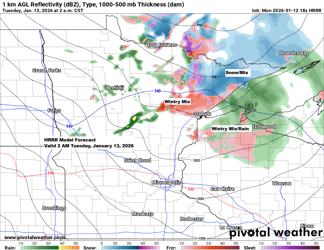
The next clipper will slide southeast across the Northland late tonight into Tuesday morning, bringing in warmer air along with a mix of snow, sleet, and some patchy freezing rain. While the precipitation should be light and short-lived, even a bit of freezing rain can make roads slick, so watch…
-
The Clipper train is back.
After a pause in the clipper train, it looks like we’re shifting back into a pattern that’s favorable for clipper systems to move through the upper Midwest over the next 5 to 7 days. Clippers are weather systems that come from Canada and move southeast along a northwesterly flow aloft.…
-
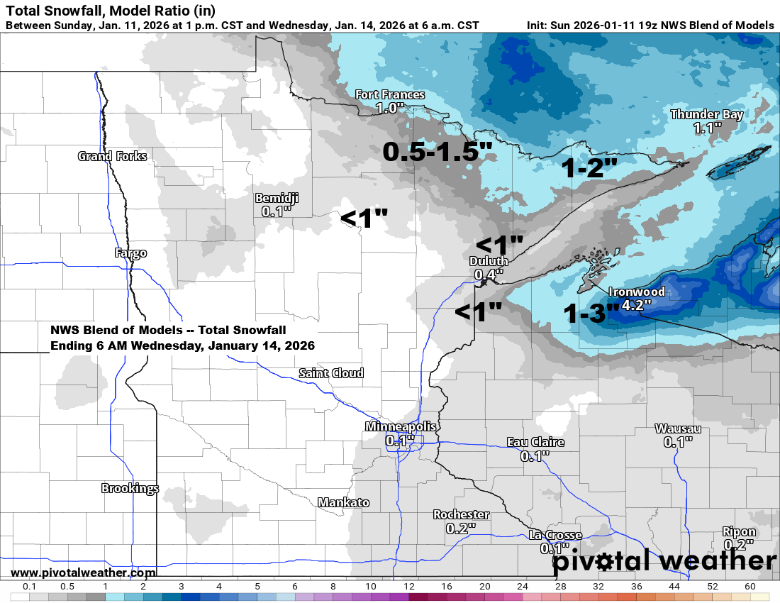
It’s going to snow on Tuesday.
We’re getting a break from the snow today, but another round is on the way for Tuesday as we slip back into a clipper pattern. In Duluth and Superior, Expect snow on Tuesday from around 5 AM to 11 AM, with totals between 0.5 and 1.5 inches. It’ll be light…
-

There’s a chance of snow, sleet, and freezing rain from Thursday evening through Friday morning.
A messy weather system is expected to move in later this week, mainly from Thursday evening through early Friday morning. This system could bring a mix of snow, freezing rain, and sleet to northeast Minnesota and northwest Wisconsin, with at least minor impacts likely from snow and ice buildup. Note:…
-

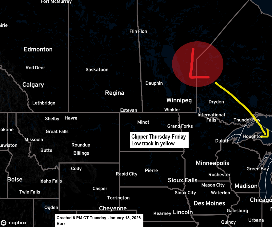
Weather Update: Next Clipper System Approaching the Northland
Thursday’s clipper has moved over Quebec today, and upstream we can see the next clipper low approaching. It’s a strong system as well, though not quite as intense as Thursday’s. A burst of strong warm air advection brought some snow to northeast Minnesota and northwest Wisconsin this afternoon and early…
-

A light snowfall is expected Friday morning, followed by gusty winds and bitterly cold temperatures.
A light burst of snow is expected Friday morning, ushering in the next wave of arctic air. Accumulations should be about an inch or less, and the snowfall will likely only last an hour or two at most. An Arctic air mass with 850mb temperatures ranging from about -23 to…