Tag: marginal risk
-
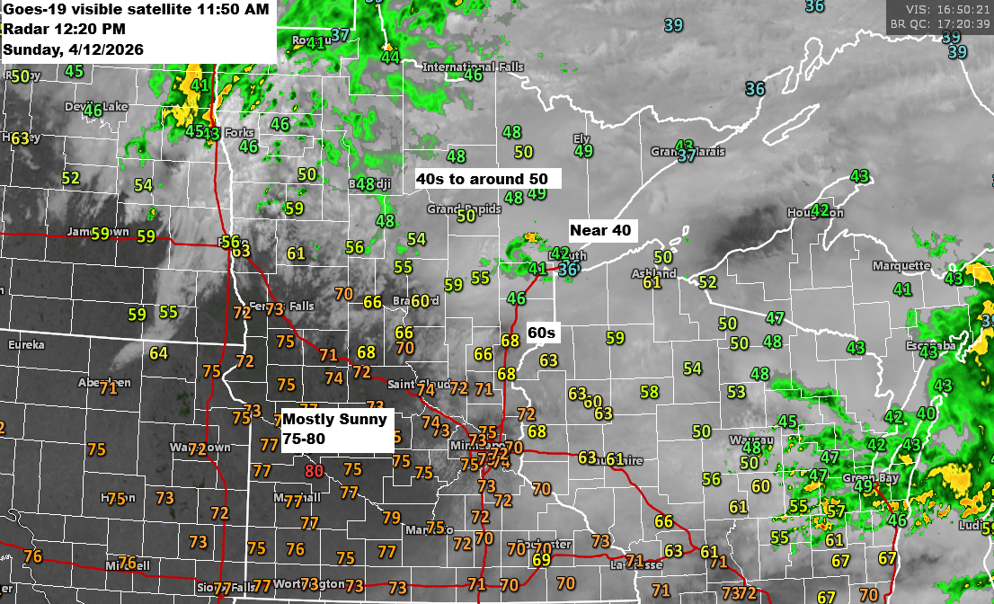
12 PM Weather Update for 4/12/2026: There’s a low chance of isolated strong to severe thunderstorms developing late this afternoon into the early evening.
Early this afternoon finds an area of low pressure over eastern North Dakota near Fargo with a warm front draped southeast through central Minnesota into central Wisconsin. For the rest of the day, the low will drift east-northeast, pushing the warm front farther north, while a cold front sweeps southeast…
-
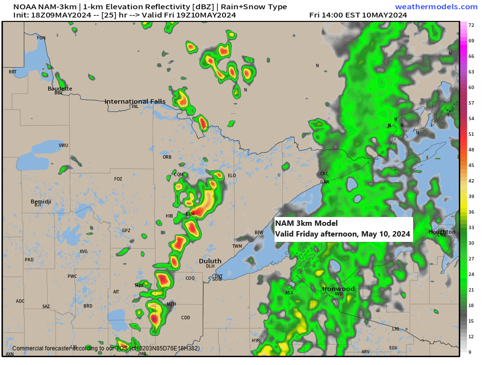
Frost/Freeze potential tonight; Scattered showers and t-storms Friday; Highs in the 60s and 70s this weekend
5:59 PM Thursday, May 9, 2024 The convergence of a moving cold front and a zone of colder upper-air temperatures, reaching as low as approximately -25°C, along with warmer surface temperatures, will contribute to atmospheric instability on Friday. This instability is expected to result in isolated to scattered showers and…
-
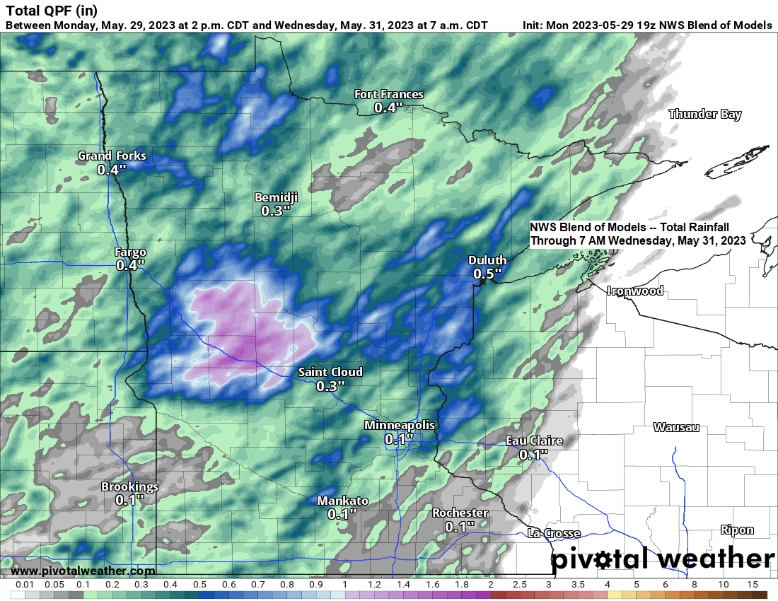
Warm and turning more humid with isolated to scattered rains the next few days
5:11 PM Monday, May 29, 2023 Rainfall anomalies in the Northland for May 2023 (thru 4 PM on the 29th) Ashland, WI: -2.89″ below normalDuluth, MN: -2.33″ below normalHibbing, MN: -1.79″ below normalBrainerd, MN: -1.76″ below normalInternational Falls, MN: -0.75″ below normal It’s been a very quiet start to the…
-
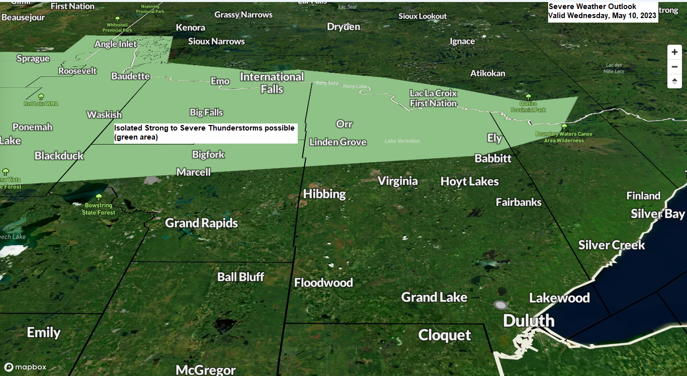
Warming trend continues the next few days with more scattered rain chances; Isolated strong storms possible in far northern Minnesota Wednesday; Stronger/Cooler NE wind Friday-Saturday
6:26 PM Tuesday, May 9, 2023 Will continue to see scattered showers in the Northland over the next few days with pockets of heavy rainfall possible similar to what’s happened over the last few days. Some of us will see very little rain, while others see more significant downpours at…