Tag: tornadoes
-
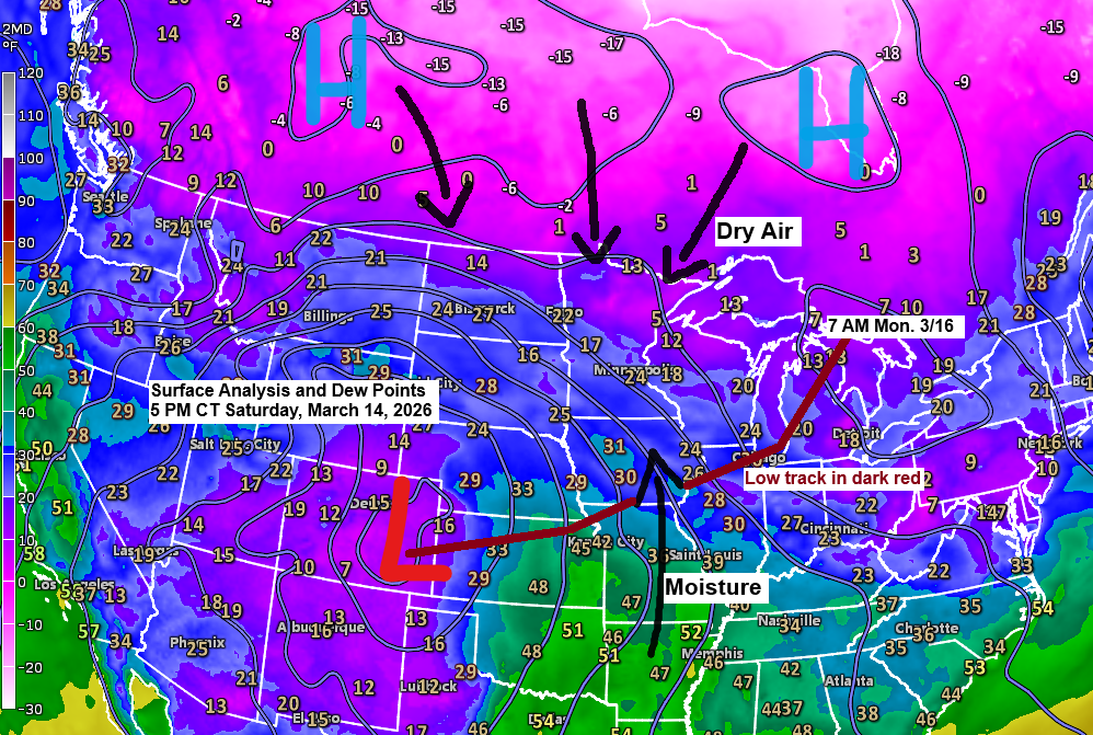
Winter Storm Update: Updated snowfall forecast as of 6 PM on Saturday, March 14, 2026.
A major winter storm is expected to sweep across much of the northern Plains, upper Midwest, and Great Lakes in the coming days, but predicting its impact is tricky, especially here in the Northland. High pressure sits to our north, while low pressure over eastern Colorado moves east-northeast toward Chicago,…
-
Dense fog and freezing drizzle into Friday morning; Some precipitation at times Friday-early Saturday
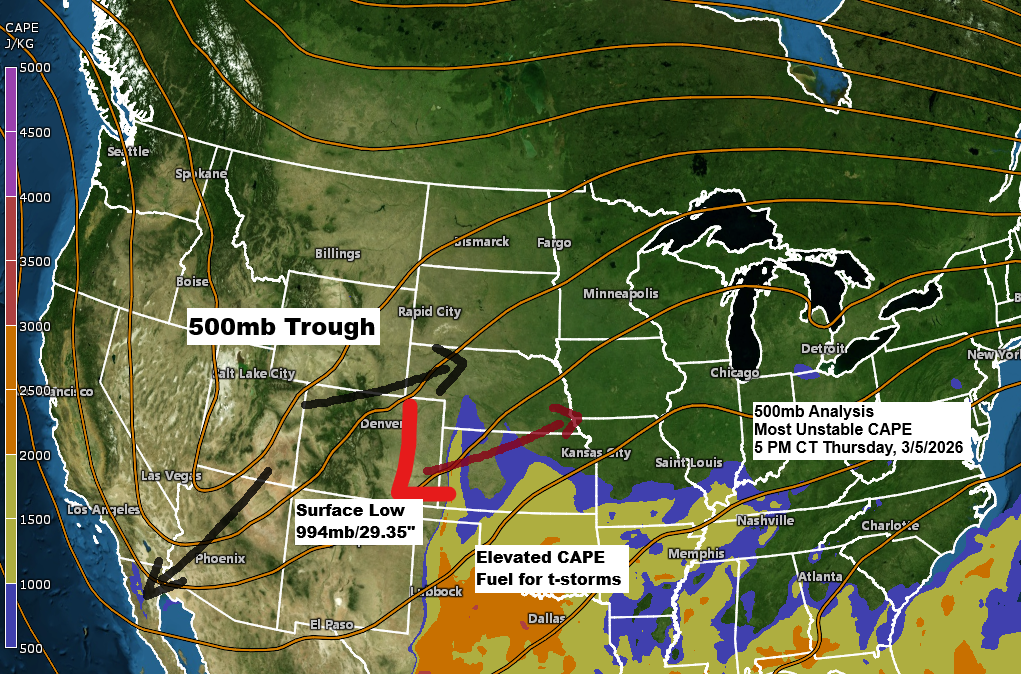
It’s a bit of a messy setup with a strong mid-to-upper level trough over the Rockies and a low-pressure system in eastern Colorado, with southwest winds aloft ahead of it. Normally, this kind of pattern could bring a strong storm to the upper Midwest, but this time the upper trough…
-
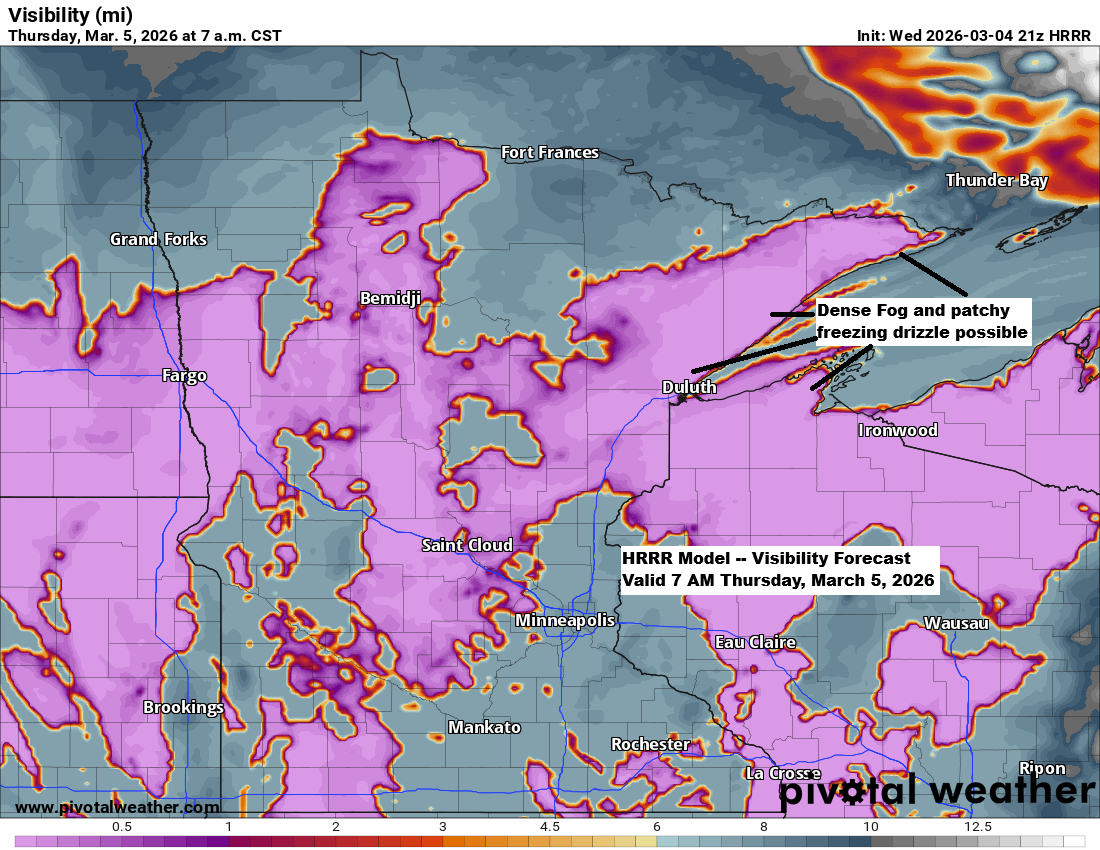
Windy, colder near Lake Superior — fog tonight, showers (rain/snow) Friday-early Saturday
Expect windy and much cooler conditions tonight and Thursday near Lake Superior, with northeast winds gusting up to 30 mph. There could also be areas of dense fog, along with the chance of patchy freezing drizzle that may leave a thin layer of ice on surfaces during this time. …NWS…
-
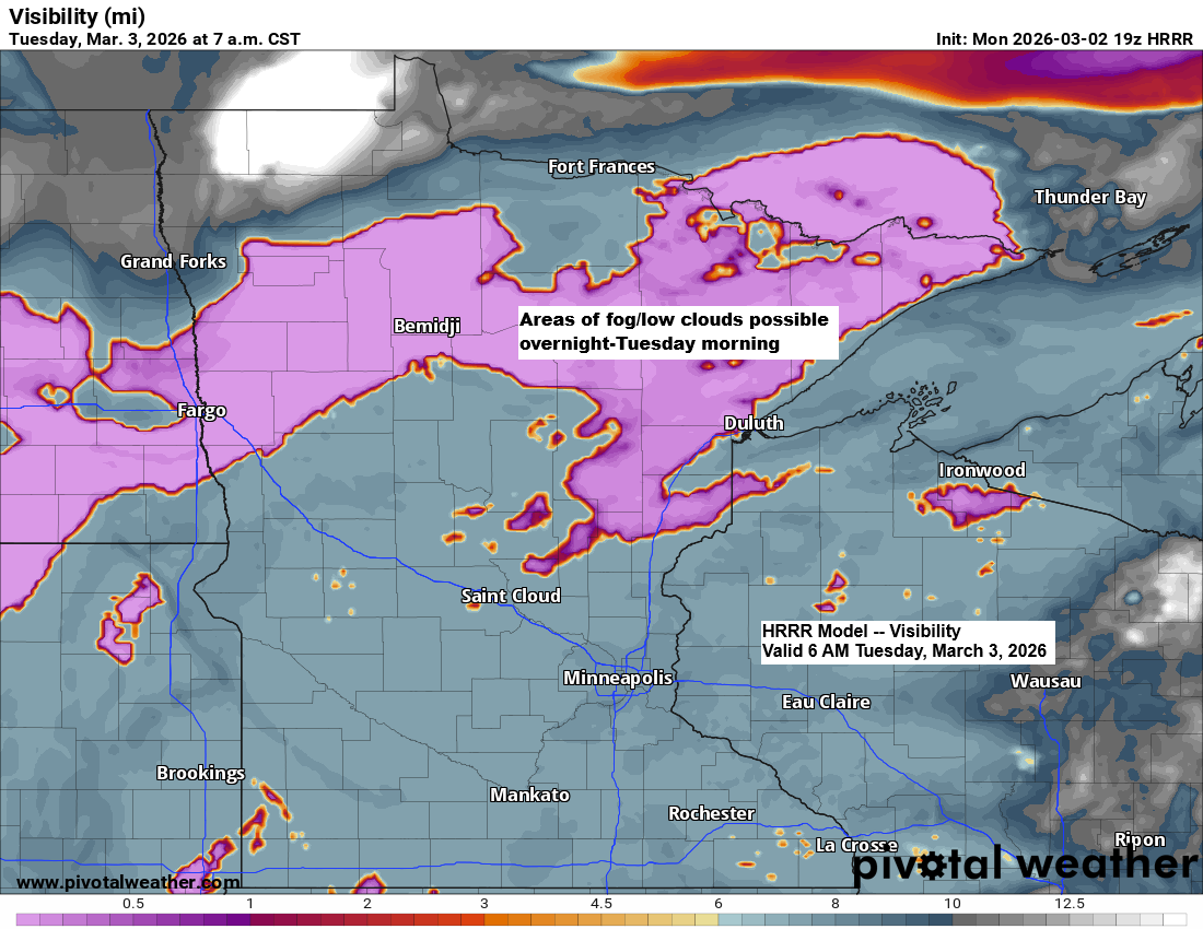
Mild week ahead with patchy fog; late‑week precipitation chances
With some snowmelt today and more expected in the coming days, there’s a good chance we’ll see low cloud cover and patches of fog forming in the Northland over the next few nights and mornings. Temperatures made a nice comeback today after the bitter cold over the weekend, with highs…
-
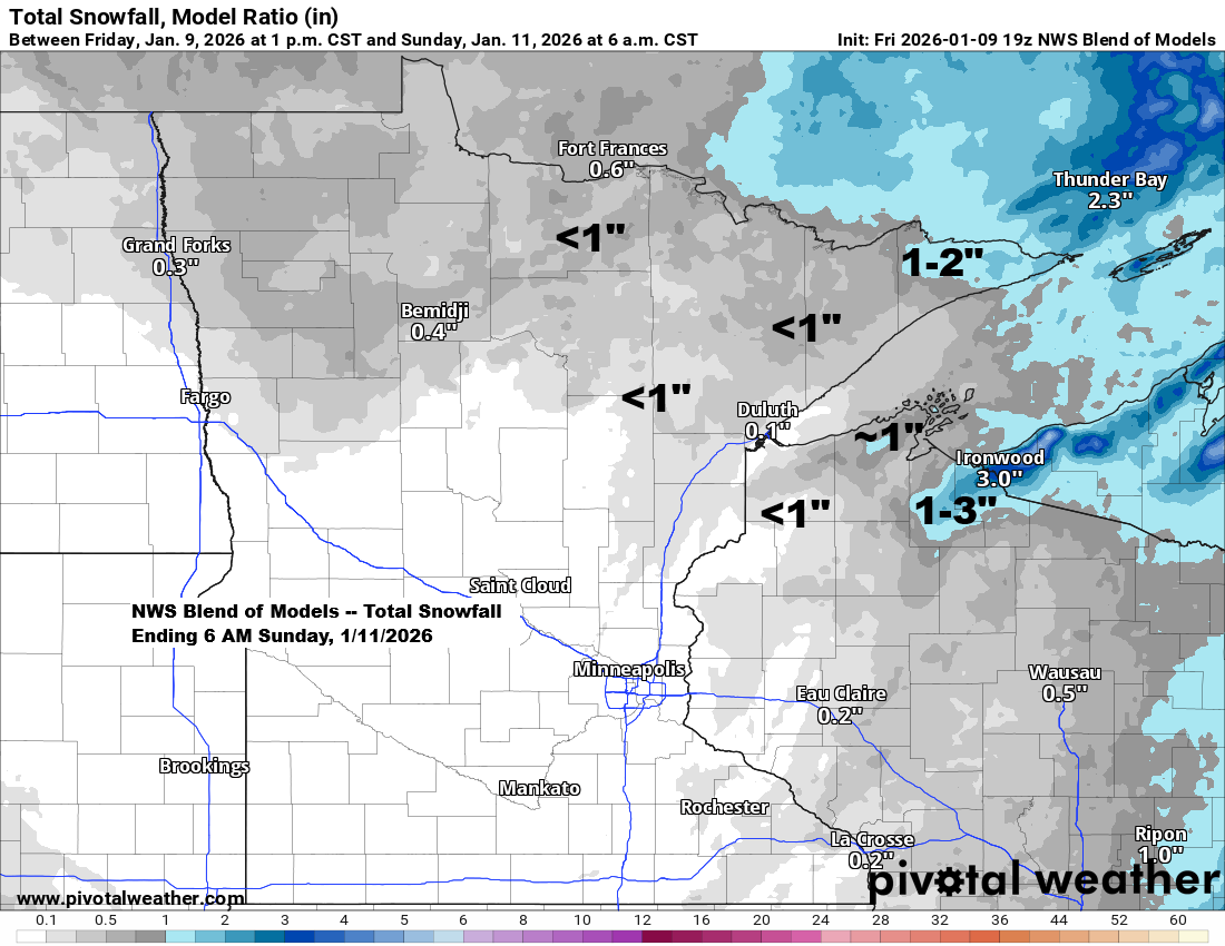
Light snow at times from tonight through Saturday, with an active clipper pattern expected next week.
A mid and upper-level low, along with a trough, will move southeast across the upper Midwest tonight and Saturday, before heading east by Saturday evening. This system will bring a little snow at times to parts of northeast Minnesota and northwest Wisconsin tonight and Saturday, but it won’t be a…
-
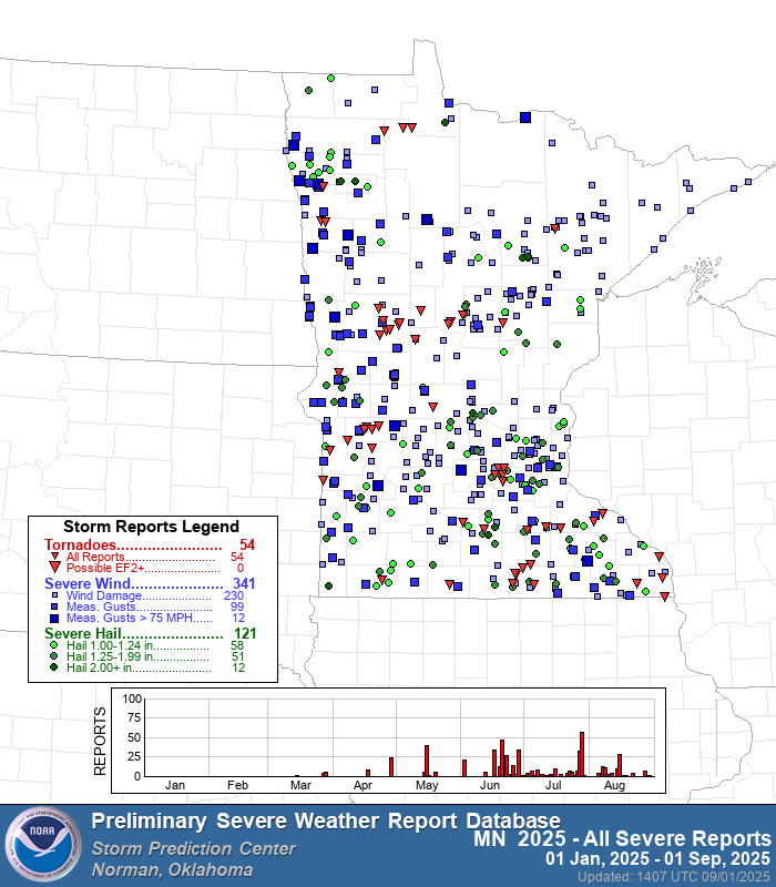
Tornado and Severe Weather Stats for Minnesota and Wisconsin 2025
Now that meteorological summer has ended, let’s review the highest Day 1 Storm Prediction Center Convective Outlook observed in northeast Minnesota and northwest Wisconsin during the summer of 2025, spanning from June 1 to August 31. Moderate risk (level 4 out of 5): One day, June 20. Enhanced risk (level…
-
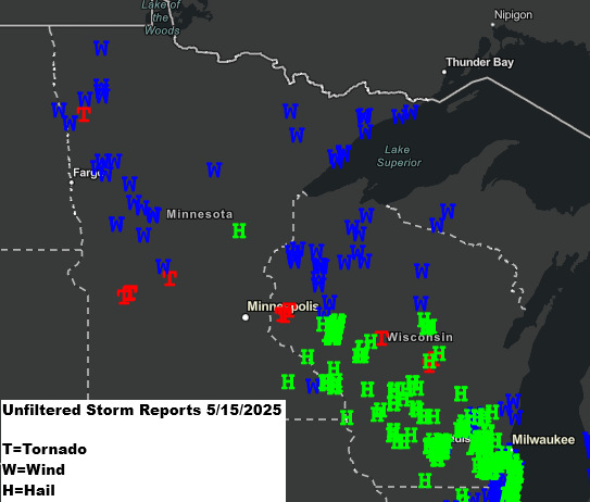
Local Storm Damage Reports: May 15, 2025
2:00 PM Friday, May 16, 2025 A line of strong to severe thunderstorms moved north over east central and northeast Minnesota and northwest Wisconsin from late Thursday afternoon to mid-evening. These storms caused wind damage reports in northwest Wisconsin, along the North Shore of Lake Superior, and in Minnesota’s Arrowhead…