Tag: wind chill advisory
-
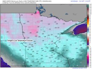
Frigid through Wednesday morning; Windy with a little snow possible Wednesday evening/night more cold air to follow
4:54 PM Monday, January 24, 2022 Another round of bitterly cold temperatures along with frigid wind chills will affect the Northland through Wednesday morning, this will be followed by a brief warmup Wednesday afternoon/night, but a gusty S-SW wind (15-30 mph) will likely accompany these warmer temps. More cold air…
-

Blustery! Arctic air returns the next few days
4:55 PM Saturday, January 8, 2022 Arctic air is returning to the Northland over the next few days. Lows tonight will range from the single digits below to around 20 below zero with highs on Sunday only in the single digits below to around zero. Lows Sunday night and Monday…
-

A frigid weekend ahead; A brief warmup early next week, more arctic air to follow; A few climate stats for 2021
Bitterly cold temperatures and dangerously cold wind chills are likely in the Northland this weekend. A Wind Chill Warning is in effect from 6 PM this evening until Noon Saturday for all of northeast, north-central and east-central Minnesota including the cities of International Falls, Bigfork, Grand Rapids, Cass Lake, Walker,…
-
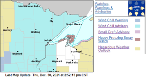
Arctic blast through this weekend, warming trend early next week; Some snow possible Friday for eastern MN into parts of northwest WI
A Wind Chill Advisory is in effect from 6 PM Friday to Noon Saturday for much of the Northland including all of northeast, east-central and north-central Minnesota, and parts of northwest Wisconsin including the cities of International Falls, Bigfork, Grand Rapids, Cass Lake, Walker, Pine River, Brainerd, Hill City, Aitkin,…
-
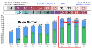
Frigid tonight-Tuesday AM; turning a little warmer midweek; 30s possible early next week; some light snow possible Wednesday-Thursday
An arctic air mass will linger over the Northland the next few days, but it will continue to slowly modify, but subzero low temperatures will likely continue most of this week, with the coldest nights being tonight and Tuesday night, with widespread lows in the teens and 20s below zero,…
-

Frigid and Dry; Wind Chill Advisory in effect thru Sunday
The coldest air in this long duration arctic blast is still to come! We’re looking at widespread 20s and 30s below zero for overnight lows in northeast Minnesota and northwest Wisconsin from tonight through Sunday night, with some 40s below even possible in the typical cold spots. Daytime highs will…
-

Bitterly cold – Wind chill headlines in effect thru Tuesday
High temperatures in the Northland today were some 20 to 30 degrees colder than normal for February 6 (normal highs on today’s date are right around 20 degrees above zero!). Duluth, International Falls, Brainerd and Hibbing all recorded a top 5 coldest high temp on record for February 6th –…