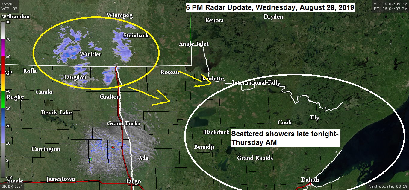
A cold front will move quickly southeast and through the Northland Thursday morning bringing scattered showers and isolated thunderstorms to northeast Minnesota and northwest Wisconsin. Note: Greatest chance for some rain in Duluth is from around 3 to 8 AM Thursday.

Source: 18z NAM-WRF model; https://weathermodels.com
Note: Radar forecast below is from Midnight tonight to 7 PM Thursday.

It’s the big one on Thursday, the 47th annual Silver 1000 at the Proctor Speedway in Proctor, Minnesota. This race marks the start of the Northland Invitational season, the big money shows!
Weather Forecast for the Silver 1000
It’ll be a windy day on Thursday with winds shifting from southwest to northwest with gusts to around 30 mph during the afternoon/early evening.
Greatest chance for rain will be early in the day Thursday, it should be dry for the race Thursday evening.
Temperatures will warm into the lower 70s Thursday afternoon, but cool off into the mid to upper 50s between 7-10 PM Thursday.
3-Day Rainfall Totals from the major climate stations around the Northland
August 25-27, 2019
- International Falls, MN: 1.62″
- Hibbing, MN: 1.20″
- Brainerd, MN: 1.00″
- Duluth, MN (Airport) 0.90″
- Ashland, WI: 0.49″
…Hurricane Dorian Update…
Source: https://www.nhc.noaa.gov
5 PM AST Wednesday, August 28, 2019
- Location: About 45 miles northwest of St. Thomas
- Maximum Sustained Winds: 80 mph
- Present Movement: Northwest at 14 mph
- Minimum Central Pressure: 997mb/29.44″
Dorian is forecast to become a major hurricane this weekend as it moves into the western Atlantic. Dorian could make landfall possibly as a major hurricane (winds greater than 110 mph) somewhere in eastern Florida to far southeast Georgia in the Sunday night/Monday time frame (September 1-2)

Hurricane Dorian looks like it’s getting better organized this afternoon per infrared satellite imagery. Source: https://www.tropicaltidbits.com

Source: https://www.spc.noaa.gov

Low temperature forecast for Thursday morning, August 29. Source: https://graphical.weather.gov

High temperature forecast for Thursday, August 29

…Weather Summary…
Deep low pressure of around 994mb was over northern Ontario this afternoon with a tight pressure gradient still in place over the upper Midwest today because of the difference in pressure between the low to the north and high pressure across the Central Plains. West winds have been gusting to around 30 mph across the Northland today.
The last of the clouds associated with the Ontario low are moving out of the Arrowhead as of 5 PM Wednesday with mainly clear skies covering the Northland late this afternoon as widespread clouds from earlier in the day pushed off to the east.
Quick changes in the weather will take place through Thursday as a cold front pushes southeast through the area. Ahead of this front a brief surge of warm air advection will send 850mb temperatures to around +10 to +15C early Thursday morning, but once the cold front moves through will have another shot of cold air advection which will drop the 850mb temperatures to +5 to +10C during the afternoon.
There will be some weak CAPE (instability) that builds northeast into the area along with steepening mid level lapse rates, this combined with a SW low level jet of 30 to 50 knots will likely lead to some shower and isolated thunderstorm development in the Northland as a cold front moves through during the morning hours.
Looks mainly dry Thursday afternoon, although a pop-up shower is possible as colder air aloft moves in with H5 temps falling to around -20C.
Wind will be an issue once again Thursday as southwest winds shift to the northwest with gusts 20 to 30 mph.
Lows tonight will mainly be in the 50s, but a few 40s are possible in the typical cool spots. Highs Thursday in the mid 60s to mid 70s (warmest temps in northwest Wisconsin and eastern Minnesota)
Note: Looks mainly dry Friday and Saturday but we could be dealing with some scattered showers in parts of the Nortland Sunday and Labor Day (Monday) with the greatest chance of rain coming on Labor Day the way it looks now.
Forecast for Duluth and Superior
.Tonight… Breezy. Clear this evening. Partly to mostly cloudy overnight. Scattered showers and possibly a thunderstorm mainly after 3 AM. Low 52 to 57. Wind west 15 to 25 mph becoming southwest 10 to 20 mph.
.Thursday… Breezy. Mostly cloudy with scattered showers and possibly a thunderstorm mainly before 8 AM. Partly to mostly sunny in the afternoon. High 67 to 72. Wind southwest 10 to 20 mph becoming northwest 15 to 30 mph.
.Friday… Partly cloudy. High 67 to 72. Wind northwest 10 to 20 mph.
Normal temperatures for August 29
- High 72
- Low 52
- Sunrise Thursday 6:24 AM CDT
- Sunset Thursday 7:54 PM CDT
Thanks for reading!
Leave a Reply