Temperatures warmed up nicely today, especially in western Minnesota where temperatures climbed into the 40s this afternoon.
Source: RTMA model; https://lab.weathermodels.com/

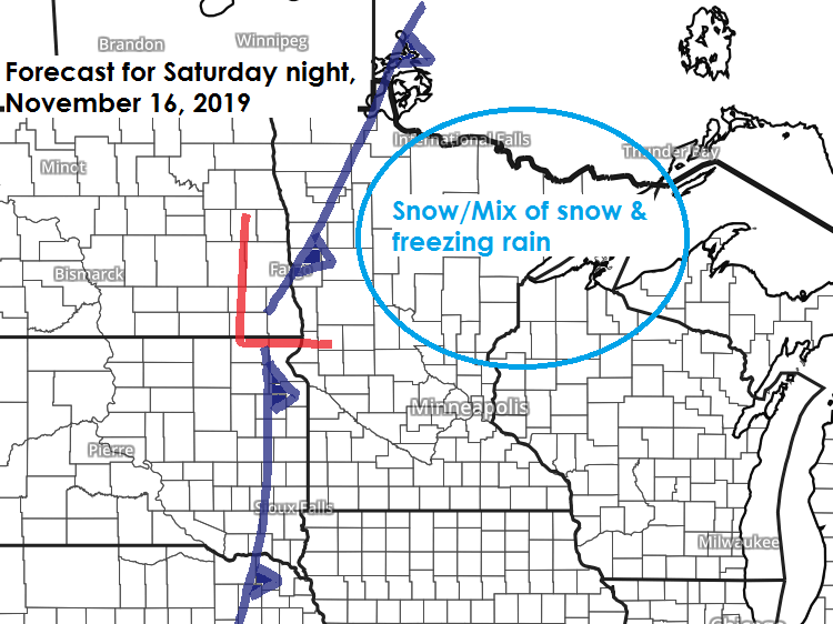
There is a chance for some snow and possibly even some freezing rain in most of the Northland from Saturday evening into Sunday morning.

Here’s my preliminary snowfall forecast for Saturday night-Sunday.

Low temperature forecast for Friday morning, November 15. Source: https://graphical.weather.gov/

High temperature forecast for Friday, November 15

We’ve got quite a battle brewing in the long range between the European Ensemble model (EPS) and the GEFS model.
Euro ensemble model continues to show a milder weather pattern for the Northland from November 18 through 27, while the GEFS model is colder.
The difference between the two models would mean highs in the 30s per EPS model or the low-mid 20s per GEFS model during the aforementioned time period. Stay tuned.
Source: https://weathermodels.com/


…Weather Summary…
A reinforcing shot of cold, arctic air is moving E-SE across Ontario today but this next batch of arctic air will just give a glancing blow to the Northland as the heart of it slides by to the NE.
850mb temperatures at 5 PM Thursday ranged from -16 to -22C in central/western Ontario to around 0C in western/southern Minnesota.
Cold front will move south across the Northland tonight while a strong area of high pressure slides east across Ontario on Friday.
Mostly cloudy skies this evening with a chance for patchy light freezing drizzle and flurries followed by partly to mostly cloudy skies from late tonight through the day Friday.
Lows tonight will range from the single digits in far northern Minnesota to the teens to around 20 degrees elsewhere. Highs on Friday will mainly be in the 20s.
Winds will shift to the northwest tonight at 10 to 20 mph with higher gusts possible. Winds on Friday will shift from the north to the east at 10 to 20 mph with the strongest winds occurring prior to Noon.
Temperatures will be a little milder this weekend with highs Saturday and Sunday near or a couple degrees above the freezing mark, but along with the milder temps comes the risk for some snow or mixed precipitation Saturday night into Sunday as a cold front moves across the region.
Forecast for Duluth and Superior
.Tonight… Breezy. Mostly cloudy, then partly to mostly cloudy overnight. Few flurries possible. Low 15 to 20. Wind southwest 15 to 25 mph becoming northwest.
.Friday… Breezy during the morning. Partly cloudy. High 25 to 30. Wind northwest 15 to 25 mph becoming east at 5 to 15 later in the day.
.Saturday… Mostly cloudy. High 30 to 35. Wind south to southeast 10 to 20 mph.
Normal temperatures for November 15
| High 36 Low 22 | |
| Sunrise Friday 7:11 AM CST Sunset Friday 4:35 PM CST |
Thanks for reading!
Leave a Reply