Precipitation totals ranging from around 0.01 to 0.10 inches are possible in most of northeast Minnesota and northwest Wisconsin Tuesday and Tuesday night with locally higher amounts possible, especially in the far Arrowhead (North Shore) with potential for up to a half inch of precipitation.
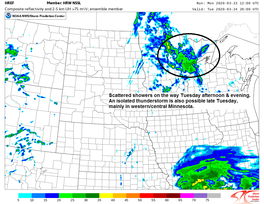
Source: 12z HREF model 3.23.20; https://www.spc.noaa.gov/

Simulated radar forecast from 7 AM Tuesday to 7 AM Wednesday.
Source: 12z WRF-ARW model 3.23.20; https://www.tropicaltidbits.com/

Weather turns a little more active the next few days as a couple of disturbances embedded in the WSW flow pass through the upper Midwest. One disturbance moves through on Tuesday, this will be followed by a stronger disturbance on Wednesday.
Source: 18z NAM 3.23.20; https://www.pivotalweather.com/

On again, off again. Seems to be a common theme in the computer models when it comes to whether or not winter storms will affect the Northland.
Well, there is a system showing up on the models for late this week, around March 27-28. Euro, UK and Canadian guidance are much farther north with the storm track, enough so that it would bring a risk for accumulating snow to parts of the Northland late this week, but the GFS model has been consistently showing this system tracking much farther south with no precipitation affecting our area. Stay tuned.
Shown below is the 12z European ensemble model 3 inch or greater snowfall probability forecast for the March 27-28 system.
Source: https://weathermodels.com/

Low temperature forecast for Tuesday morning, March 24, 2020. Source: https://lab.weathermodels.com/

High temperature forecast for Tuesday, March 24, 2020.

…Weather Summary…
Dry tonight under mainly clear skies, but clouds will start to increase overnight. Lows will be in the teens and 20s with single digits possible in the typical cold spots. Winds tonight will shift to the east or southeast around 10 mph.
More clouds than sun for Tuesday with a chance for some rain showers, this rain will occur as warm air advection increases on southerly winds out ahead of a cold front which will be over the Dakotas.
S-SW 850mb jet >30 knots will be aimed over the Northland later Tuesday which may help advect a bit of instability into our area with potential for MUCAPE of around a hundred J/kg along with a steepening of the mid level lapse rates, potentially to around 7.5 c/km, the combination of those ingredients could be just enough to help develop an isolated thunderstorm late Tuesday afternoon or Tuesday evening, but overall this should be mostly a light to moderate rain shower event.
Highs on Tuesday are forecast to be in the 40s with 30s along the North Shore. Winds will be out of the south or east at 10 to 20 mph.
Cold front pushes south/east of our area on Wednesday, but an area of F-GEN is forecast to pass through parts of the upper Midwest resulting in an area of rain and wet snow which could clip southern portions of the Northland on Wednesday, roughly south of a line from Brainerd to Ashland. Highs Wednesday are forecast to be in the 30s to around 40 degrees.
Note: Euro and GFS models are indicating quite a warm up for early next week which could send our highs into the 60s here in the Northland around March 30 to April 1. Whether or not the models continue to show this a few days from now is another story. By the way, the average date for 1st 60 degree temperature in Duluth is April 12 (1875-2019 climate period) Last year’s 1st 60 in Duluth occurred on April 16.
Forecast for Duluth and Superior
.Tonight… Mostly clear. Low 20 to 25. Wind east to southeast around 10 mph.
.Tuesday… Mostly cloudy. Scattered rain showers, especially during the afternoon and evening. High 37 to 42. Wind southeast 10 to 20 mph.
.Wednesday… Mostly cloudy. High 35 to 40. Wind northwest 10 to 15 mph.
| Normal temperatures for March 24 High 38 Low 21 Sunrise Tuesday 7:03 AM CDT Sunset Tuesday 7:28 PM CDT |
Thanks for reading!
Tim
Leave a Reply