High of 81 degrees in Duluth today! Should be close to 80 degrees again on Wednesday, then will see temperatures drop to the 50s to around 60 degrees Thursday before warming up a bit Friday and Saturday, but more cool air is likely for next week.
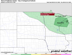
Showers and thunderstorms are possible across the Northland beginning late Wednesday afternoon, but more so Wednesday evening into early Thursday morning. Storms will be capable of producing downpours and lightning, and there is also a chance for isolated stronger thunderstorms which would have the potential to produce hail up to 1 inch in diameter (quarter size) and wind gusts to 60 mph. Note: The greatest chance for storms Wednesday night appears to be setting up across north-central into east-central Minnesota and northwest Wisconsin, mainly south of a line from around Bigfork to Silver Bay, but this area could shift even a bit further south over the next 24 hours. Stay tuned.

Here’s the 18z NAM 3km model radar forecast valid from 1 PM Wednesday to 1 PM Thursday.
Most of the day Wednesday looks dry in northeast Minnesota and northwest Wisconsin. This will be followed by increasing chances for showers and thunderstorms Wednesday evening into the overnight, with dry weather returning during the day Thursday.
Source: https://weathermodels.com/

Rainfall of a half inch or more is possible Wednesday night across portions of east-central Minnesota and northwest Wisconsin, but much lower rainfall amounts of only a trace are expected up around the International Falls area.
Source: https://lab.weathermodels.com/

Another warm day ahead for the Northland on Wednesday with highs in the 70s and lower 80s, but this will be the last real warm day will see, possibly for the rest of 2020.
Model images – 18z NAM 3km

Will cool off quite a bit on Thursday with highs in the 50s and lower 60s, but this is actually closer to where we should be for late September. It also looks a tad windy on Thursday especially near Lake Superior where a northeast wind could gust to around 20 to 25 mph for most of the day.

What a nice day across the Northland!
81 degrees in Duluth today, the normal high on September 22nd is 62 degrees.
Although temperatures were well above normal today, no records were broken, but Duluth and Hibbing came within 5 degrees of the day’s record high temperature (Duluth missed their record by 3 degrees, Hibbing by 4 degrees)
Today’s 80 in Duluth is the first 80 degree or warmer temperature since August 26th when the temperature reached 86 degrees.
We’ve had 40 days so far this year with a temperature of at least 80 degrees in Duluth, last year saw 45 days at or above 80 degrees. Average number of 80 degree days in a year is 26 days.

Euro ensemble model continues to show a wetter pattern setting up across the Northland for the rest of this month with a couple rain events possible across our area which could lead to above average precipitation totals thru September 30th.
The next chance for some rain after Wednesday night comes on Friday, and there are more rain chances lined up for early next week (~September 27 to September 30)
Source: https://weathermodels.com/

Seeing much better model agreement today regarding the temperature forecast for next week.
Next week is looking quite a bit cooler across the Northland especially when you compare it to this week’s temperatures.
Will probably be stuck in the 50s for daytime highs for most of next week, and there is even a chance that some locations remain in the 40s on a few days next week.

Source: https://www.tropicaltidbits.com/

Thanks for reading!
Tim
Leave a Reply