Widespread fog will be found across northeast Minnesota and northwest Wisconsin tonight with visibilities as low as a mile or less. Fog is expected to burn off in most of the area after 8 AM Wednesday, but whether or not the clouds break up on Wednesday remains to be seen.
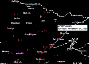
Visibility forecast thru 9 AM Wednesday per 21z HRRR model, with the blue and black colors on the animation below representing visibilities of a mile or less.
Source: https://weather.cod.edu/

Temps across the Northland early this evening are hovering close to the freezing mark, but temperatures won’t fall much tonight as they remain in the 28 to 33 degree range. With temps close to or a few degrees below freezing there could be some patchy freezing drizzle/icy spots on roads and sidewalks tonight into early Wednesday morning, but by Wednesday afternoon temperatures should warm above freezing, possibly as warm as 36-37 degrees in some locations across the Northland.

Quite a storm pulling east out into the Plains tonight, but this system and its precipitation will remain well south of the Northland.
Goes-16 water vapor loop from Tuesday, November 24, 2020 – Loop time ~1 PM to 4:46 PM CT.
Source: https://www.star.nesdis.noaa.gov/

An area of low pressure located near the Kansas/Oklahoma state line as of 5 PM Tuesday is forecast to lift NE, reaching the eastern Illinois-Indiana state line by Wednesday evening.
A widespread area of precipitation accompanies this system with snow to the north (white areas on map) and rain to the south (green areas on map) And there’s even some severe thunderstorms occurring in parts of Oklahoma late this afternoon with a Severe Thunderstorm Watch (yellow area) in effect until 9 PM this evening.
Note: There wasn’t much precipitation in the Northland today, with Duluth only picking up 0.3″ of snow today, while 0.5″ of snow fell at International Falls. Snow to liquid ratios today ranged from as low as 3:1 at Duluth to a more typical 10:1 at International Falls.

Looks like we are heading into a relatively quiet period of weather across the Northland, and this has potential to linger for quite a while, possibly upwards of 2 weeks. I don’t see any major system impacting our area at least through the first week of December, but we will likely see a couple of northern stream waves/cold fronts and troughs move through the area on occasion, and those could bring a few flurries at times, but not a whole lot in terms of accumulating snowfall.
- Cold front number one moves through the Northland on Thanksgiving
- Trough moves through the area on Friday
- Another cold front for Saturday night
Source: https://weathermodels.com/

That is one snowless forecast for Duluth, Minnesota.
Here’s the 15-day Snowfall Forecast per 12z Euro ensemble model from Tuesday, November 24, valid thru December 9. There’s only 8 out of 50 (16%) members showing >3″ of snowfall in Duluth over the next 2 weeks.
Source: https://weathermodels.com/

Next week continues to look warmer than average across Canada into the northern U.S., while colder than average temperatures setup across the southern/eastern U.S. Note: This kind of temperature pattern doesn’t resemble a La Nina at all.
For northeast Minnesota and northwest Wisconsin we are looking at daytime highs in the 20s and 30s next week, with overnight lows in the teens and lower 20s, but there is a chance for colder temps early next week, with a possibility for some single digit overnight temps for parts of the area, but this really isn’t that cold for this time of the year.
Source: https://weathermodels.com/

Such a bizarre looking weather pattern for next week as very strong ridging sets up over Canada while at least one (if not more) strong upper level low/s drops south out of the Midwest and into the eastern U.S.
Overall this should be a fairly quiet pattern next week for northeast Minnesota and northwest Wisconsin the way it looks now.
Shown below is the 12z Euro Ensemble model – 500mb height anomaly forecast valid from Monday, November 30 to Friday, December 4, 2020.
Source: https://www.pivotalweather.com/

Thanks for reading!
Tim
Leave a Reply