Month: December 2020
-
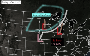
Accumulating snow or a rain/snow mix possible in the Northland ~Dec. 11-13
The last time Duluth picked up at least an inch of snow was back on November 22 (1.6″) 31.2″ of snow so far this season at Duluth, Minnesota, this is +12.4″ above normal thru December 5. Last year’s snowfall total thru December 5 was 35.8″ Another mild week ahead in…
-
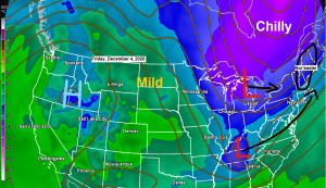
No major snow events in the Northland through late next week; shot at 40 degrees ~Dec. 8-10
A few disturbances will be dropping SSE across the Northland into early next week, with one such feature moving through the area on Saturday, followed by another for Sunday, and possibly one more Monday night. None of them look to produce more than some clouds and possibly a few snow…
-
A mild and dry weather pattern continues across the Northland
Daytime highs at or above freezing are expected to continue in Duluth through next Thursday. Note: Our normal high in Duluth in early December is around 25 degrees, but our highs will be at least 5 to 10 degrees above normal for the next week. Source: NWS blend of models;…
-
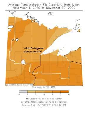
Climate Summaries for November 2020
*November 2020 was warmer than average across the Northland, with Duluth, International Falls, Hibbing, Brainerd and Ashland all recording a top 20 warmest November on record. Average temperatures for the month finished about 4 to 5 degrees above normal. *Snowfall and precipitation totals varied considerably across the Northland in November…