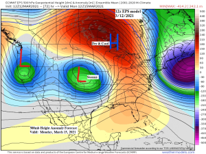
The weather pattern across the Northland goes right back to one that features dry and quiet conditions for at least the next 5-7 days as a strong ridge across Ontario and Great Lakes deflects all the wet/stormy weather to our south. Some signs the pattern could change a bit after March 21st which could lead to greater chances for rain or snow to return to the Northland, but until then it looks pretty dry around here.
Precipitable Water forecast valid from Sunday morning through Monday evening.
Dry air shows up as brown colors, while moisture shows up as green colors on the animation below.
Northeast Minnesota and Northwest Wisconsin will remain in a dry air mass for Sunday and Monday, while deeper moisture along with some rain and snow lifts north into parts of the Dakotas and southern Minnesota starting late Saturday, but more so Sunday and Monday, but this precipitation shouldn’t make it too far north due to the dry air and ridge which will cover the Northland.
Note: A few of the computer models (Euro and UK) were showing some accumulating snow affecting parts of the Northland next Monday and Tuesday, but those models have trended farther south with its QPF, and are now in strong agreement with the GFS and NAM models in keeping the entire Northland dry early next week.

- We had several locations in northern Minnesota drop down into the single digits this morning, including a few locations dropping below zero, Babbitt -3 F, 25 miles east of Ely -2 F, and Cass Lake -1 F.
- Saturday is still shaping up to be one of our warmest days will see in the Northland at least through the middle of next week. Highs on Saturday will be in the 50s, although slightly cooler temps are possible where a deeper snow pack exists.
- A gusty northeast wind develops on Sunday and will likely continue on Monday as well, this will help to keep daytime highs in the 27 to 33 degree range near Lake Superior on those days, while winds gusting to around 20-25 mph off the lake will certainly add an extra chill to the air. Farther inland, highs will be in the 30s to around 40 degrees on Sunday and Monday.
…Record Highs for March 13th…
Looks like our record highs for March 13th will be safe, but Hibbing and International Falls might get pretty close to their records on Saturday.
- International Falls: 59 F set in 2016
- Duluth: 58 F set in 2015
- Hibbing: 57 F set in 2012
It’s going to be an active next few days from the Rockies east to the Plains as two storm systems impact those areas (storm track in white) Moisture returning north from the Gulf (green) along with dry air and strong mid/upper level winds (orange) will lead to multiple days with a severe weather threat across parts of the Southern Plains into the middle of next week.

Heavy Snow for parts of the Rockies and Western High Plains the next few days, while a flood and severe weather risk exists farther to the south and east.

Slight (yellow) and Marginal (green) risks for severe thunderstorms tonight.

A higher end severe weather day is possible for Saturday with an Enhanced (orange) risk for severe thunderstorms in place for parts of north Texas and western Oklahoma. A few strong tornadoes are possible on Saturday especially in the enhanced risk area.

Tim
Leave a Reply