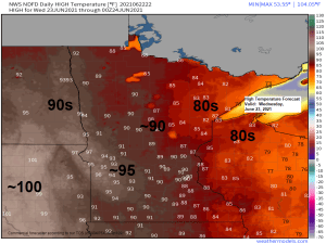
Isolated strong to severe thunderstorms are possible across all of northeast Minnesota and northwest Wisconsin from late Wednesday afternoon into early Thursday morning.
The main hazards from storms that may become severe are from damaging wind gusts to 60 mph and large hail to 1″ in diameter or quarter size, again timing of this looks to be from late Wednesday afternoon in far northern areas, to more of a mid to late Wednesday evening/early Thursday morning time frame farther south/east including the Brainerd Lakes, eastern Minnesota and northwest Wisconsin.
Heavy rain and lightning will also occur with any thunderstorm late Wednesday afternoon into early Thursday morning.
Note: The setup for Wednesday has some good things to it, but also some not so good things to it.
-Moisture is pretty limited with dew points generally peaking in the mid 50s and low 60s.
-Mid Level Lapse Rates look decent as we get a plume of steeper lapse rates to move over the area off an elevated mixed layer (EML) which will be over the High Plains.
-An increasing low level jet possibly as strong as 30-40 knots Wednesday night, this LLJ will help advect deeper moisture and more instability into the Northland, although much of the instability in our area will be elevated, but when combined with the shear and lapse rates, this could increase the chances for severe criteria hail (1″ diameter) in parts of the area.
-Strong winds aloft which will also help increase the amount of wind shear over our area.
Will see how all this plays out.

Here’s a look at two computer model radar simulation forecasts valid from 1 PM Wednesday to 7 AM Thursday.
18z NAM 3km model — Scattered showers and thunderstorms develop in far northern portions of Minnesota late Wednesday afternoon then spread and or develop farther south/east Wednesday night before moving out of the area between 5-7 AM Thursday.

18z HRRR model — A pretty similar outcome, with scattered showers and thunderstorms moving NW-SE across the Northland Wednesday evening/Overnight.

There will be pockets of heavy rainfall (amounts 0.50″-1″) with the scattered storms in northeast Minnesota and northwest Wisconsin Wednesday night as precipitable water climbs to around 1.10″-1.80″ area-wide, but storm coverage will be scattered, some will get hit, others not so much.

Looks like a real wet pattern setting up from the Midwest to the Central/Eastern Great Lakes later this week into early next week with several inches of rain possible which may lead to some flooding concerns. At the moment it looks like the Northland will miss out on this wetter pattern.

…Average Temperatures in the Northland for June 2021 (thru the 21st)…
Average temps in the Northland this month are running 4 to nearly 8 degrees warmer than average thru the 21st.
- Brainerd, MN: 71.6 F (warmest June on record 72.3 F set in 1933)
- Duluth, MN: 66.5 F (warmest June on record 65.5 F set in 1910)
- International Falls, MN: 65.3 F (warmest June on record 68.1 F set in 1995)
- Ashland, WI: 64.1 F (warmest June on record 66.5 F set in 1988)
- Hibbing, MN: 63.6 F (warmest June on record 66.7 F set in 1961)
It’s been an upside down month for temperatures, with the north being well above average, while the south has been near to below average this month.

Tim

Leave a Reply