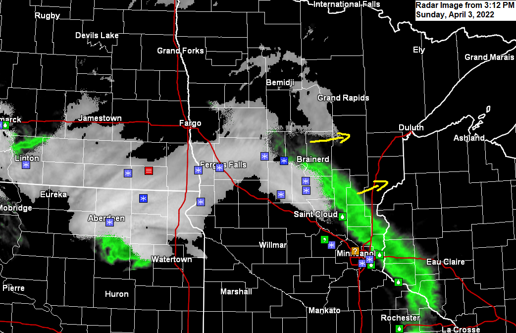
3:12 PM Sunday, April 3, 2022
Parts of east-central and northeast Minnesota into northwest Wisconsin will see some wet snow or a mixture of rain and snow this evening through early Monday morning with some slushy snowfall accumulation likely.
For Duluth — Precipitation begins this evening around 7-9 PM with wet snow being the main precipitation type tonight, although some rain is possible at the onset. Most of the snow ends early Monday morning around 2-4 AM, but we could see some flurries or snow showers linger through 6 AM Monday. Total snowfall accumulations of 1 to 2 inches.
Simulated radar forecast through 7 AM Monday
Snow (blue)
Rain (green)

Here’s my snowfall accumulation forecast for tonight’s event.
These late season snow events are a little more difficult to forecast since the pavement is quite a bit warmer now compared to just a month ago, so even if it is snowing it still may have difficulty accumulating on pavement due to the warmer temperatures but given that this snow will fall after dark (cooler portion of the day) should help produce at least some slushy snow accumulations in parts of the Northland tonight.

The system which will be affecting parts of the upper Midwest tonight is rather strong, but it is moving along pretty quickly and will exit the area by around daybreak on Monday.
Goes-16 water vapor loop from Sunday, April 3, 2022.

A pretty strong mid-upper-level trough will continue to move east out of the Dakotas tonight.

Enhanced lift in the atmosphere is occurring near and to the ENE of the mid and upper-level trough today and this area of more favorable lift will be passing through southern parts of the Northland tonight which will help produce some wet snow or a rain-snow mix.

A big-time temperature contrast in place today with 30s in northern Minnesota to the 80s in parts of western Oklahoma and the Panhandle of Texas.

Any snow that does accumulate in the Northland tonight will likely melt by Monday afternoon as temperatures climb into the 40s to around 50 degrees, but it will be cooler near Lake Superior due to an easterly wind.

Thanks for reading!
Tim
Leave a Reply