5:54 PM Wednesday, May 4, 2022
-The weather pattern will remain quiet locally through Saturday.
-Lake breezes continue through this weekend with highs in the upper 30s to upper 40s within about 10-20 miles of Lake Superior.
-Warmer temperatures inland with highs mainly in the 60s Thursday through Saturday.
-Rain chances return on Sunday with more chances for rain next week.
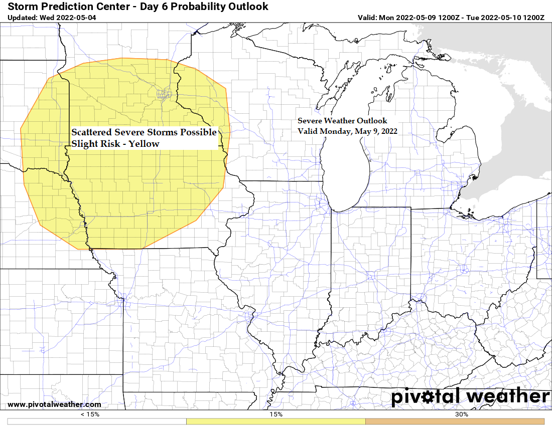
-Risk for a few severe thunderstorms from the southern half of Minnesota into western Wisconsin on Monday with additional chances for a few strong to severe storms possible in parts of the upper Midwest throughout next week.
A nice spring day across the Northland with highs today in the mid 50s to low 60s, with the typical cooler by the lake (40s).
Duluth Airport had a high temperature of 55 degrees today, Wednesday, May 4th, this is the first 50 degree or warmer temperature since April 9th. And today’s high of 55 matches the warmest temperature of the year thus far (55 on March 20th).

Computer models have been pretty consistent in showing a major shift in the pattern for next week, with even the more progressive GFS model now much more amplified with the pattern next week. We now have strong agreement between the EURO and GFS models on how the pattern sets up next week.
1: A strong 500mb trough (blue and purple) covers the western U.S. and at times spills into the Northern Plains.
2: A strengthening 500mb ridge (red, orange and white) extending from the Central Plains and Midwest into the upper Midwest, Great Lakes into eastern Canada.
3: A cutoff upper-level low pressure system retrogrades from the west Atlantic into the southeast U.S. mid to late next week.
The main uncertainty at this point would be how long the ridge sticks around for, but the trend over the last day or so would be for this ridge to persist for much of next week with it peaking in intensity toward the middle to end of next week.
The upper Midwest including here in the Northland will be dominated more by the ridge vs. the trough but will be close enough to that western trough to where will likely see periods of showers and thunderstorms next week. This rain won’t be continuous, but it will likely be wet at times starting on Sunday and then through much of next week.
500mb Height Anomaly Forecast valid May 8th-14th, 2022.

Rainfall totals of up to an inch or more are possible in much of the Northland next week, with lesser amounts of rain for the Arrowhead and far eastern parts of northern Wisconsin.

Low level moisture is forecast to increase at times next week with a few days of humid weather possible in much of the upper Midwest.
Blue colors indicate dew point temperatures of 60 or higher!
Dew Point Temperature forecast valid 1 PM Monday, May 9th through 7 AM Friday, May 13th, 2022.

Along with a warmer and more humid air mass will come the risk for thunderstorms at times next week as the amount of instability (energy) available for thunderstorms increases next week. Whether or not we get any severe weather remains to be seen since that will come down to other ingredients such as wind shear, the presence of a low-level jet (strength of said jet) and placement and timing of frontal boundaries etc..etc..
CAPE (instability) forecast valid May 8th through May 13th — Higher CAPE (more fuel/energy) in yellow, orange, red, and purple colors.

Thanks for reading!
Tim
Leave a Reply