5:05 PM Saturday, July 30, 2022
A few showers and thunderstorms are possible tonight through early Sunday morning mostly over northern Minnesota, North Shore, and Arrowhead as a warm front lifts NE out of western Minnesota while a southwest low-level jet of up to 40 knots causes a warm air and moisture advection pattern across the upper Midwest while elevated instability continues to increase with values up around 500-2000 J/kg.
Note: No severe weather is expected with anything that develops in northern Minnesota tonight, but brief downpours and occasional lightning is possible.
Here is the HRRR model simulated radar forecast through 7 AM Sunday.

SUNDAY’S SETUP
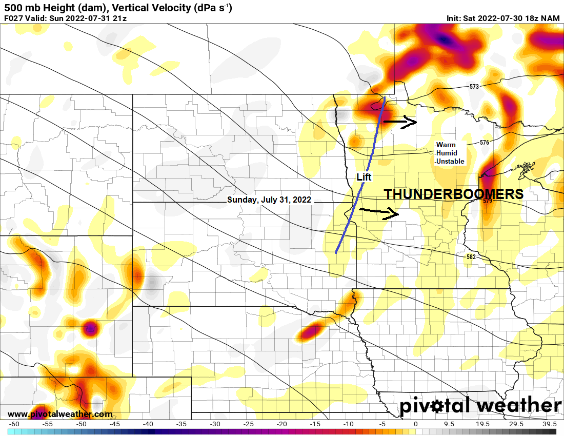
The chance for a few strong to severe thunderstorms increases in the Northland Sunday through early Sunday evening as a cold front moves east across the area later in the day.
NAM 3km model simulated radar forecast valid Noon Sunday to Midnight Monday.

All of northeast Minnesota and northwest Wisconsin is in a marginal risk for severe thunderstorms on Sunday, while far southern parts of the Northland, roughly south of a line from Brainerd to Hinckley to Siren is in a slight risk for severe thunderstorms on Sunday.
The primary severe weather hazards on Sunday include large hail to 1″ in diameter or quarter size hail, and damaging wind gusts to 60 mph.
Note: The chance for strong to severe thunderstorms is highest Sunday afternoon through early Sunday evening from around 3 PM to 9 PM.

Rainfall totals will vary considerably as they often do this time of year, but on average we’re looking at anywhere from 0.10″ to 0.50″ of rain in northeast Minnesota and northwest Wisconsin through Sunday night, with locally higher totals of 0.75″ to 1″+ possible.

Warmer temperatures returned to the Northland today with high temperatures generally in the 80s!
*11 days this month with a high of at least 80 in Duluth, normal in July is 12 days, and with another 80-degree day likely on Sunday, this will put us right at the normal number of 80-degree days during the month of July.
By the way, those 90s which are over the Northern Plains today won’t be making it this far east anytime soon as the core of the heat remains farther to our west/south which is something we’ve seen pretty much the entire summer thus far, and I really don’t see things changing a whole lot to the point where I would be concerned about getting a prolonged stretch of hot weather in the Northland at least through much of next week the way it looks now.

It is starting to feel a little more humid in parts of the area today with 60+ degree dew points becoming more widespread from eastern North Dakota into parts of western, central and southern Minnesota.
Sunday will be a touch humid in much of the Northland with dew points ranging from around 58 to 66 degrees.

Thanks for reading!
Tim
Leave a Reply