6:58 PM Sunday, October 2, 2022
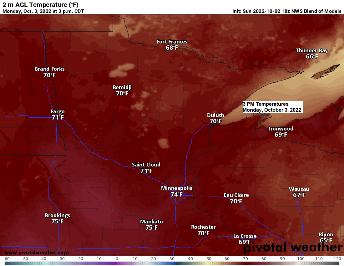
Mild temperatures will continue across the area over the next few days with daytime highs averaging +10 to +15 degrees warmer than normal for early October.
Normal highs in northeast Minnesota and northwest Wisconsin at this time of year range from the upper 50s to lower 60s, but instead will see highs in the upper 60s to lower 70s for Monday, Tuesday and Wednesday.
Temperature anomaly for October 3-5, 2022.

A much colder air mass will move into the Northland later this week with daytime highs mainly in the 40s for Thursday and Friday.
There is a chance for a little snow or a mixture of rain and snow on Thursday mainly over far northeast Minnesota (Arrowhead region), as well as over parts of northwest Wisconsin from around Butternut toward the Hurley area.
Ely, Winton, Forest Center and Eagle Mountain are just a few locations in far northeast Minnesota that may see some snowflakes on Thursday.

No widespread rain anytime soon, but we will continue to see a few isolated rain showers pass through the Northland tonight, Monday, Tuesday and also on Wednesday, but any rain that falls should remain on the light side.
18z NAM 3km model radar forecast through 7 AM Tuesday.

| There’s been a wide range in precipitation totals in Minnesota so far this year. Here are the precipitation totals, departure from normal and their percent of normal for 2022 (January 1 – October 1) International Falls, Minnesota Total: 31.65″ Normal: 20.85″ Departure: +10.80″ above normal Percent of normal precipitation: 152% of normal Duluth, Minnesota Total: 26.37″ Normal: 24.95″ Departure: +1.42″ above normal Percent of normal precipitation: 106% of normal Twin Cities, Minnesota Total: 18.51″ Normal: 26.37″ Departure: -7.86″ below normal Percent of normal precipitation: 70% of normal Note: September 2022 ranked as the driest September on record at Minneapolis with just 0.23″ of precipitation for the entire month. The previous driest September on record was in 1882 with 0.27″ of precipitation. The last time Minneapolis picked up at least 0.25″ of precipitation in a 24-hour period was on August 28 (over a month ago!) |
Above to well above normal precipitation – Green, blue and purple
Below normal precipitation – Orange and red

Thanks for reading!
Tim
Leave a Reply