4:55 PM Tuesday, October 11, 2022
A strong cold front will move quickly east across Minnesota tonight. Warm and gusty southerly winds will continue out ahead of this front through this evening before a cooling trend begins on Wednesday.
-Temperatures will be the big story over the next few days. Highs were in the 70s and lower 80s in the Northland today, but on Wednesday our highs will mainly be in the 50s which is close to normal for this time of year, just a lot cooler when you compare them to the highs on Tuesday.
-Even colder air hits Thursday and this could linger into at least early next week. Daytime highs in the upper 30s and 40s are likely in the Northland from Thursday through this weekend with overnight lows in the 20s and 30s.

Low-level jet out of the S-SW has been cranking upwards of 40-50 knots since last night, and this has advected higher amounts of moisture northward into parts of the upper Midwest this afternoon with dew points in the 50s from southern to northeast Minnesota into much of Wisconsin.

A cap or layer of warm air aloft will continue to slowly erode over the Northland through early this evening.
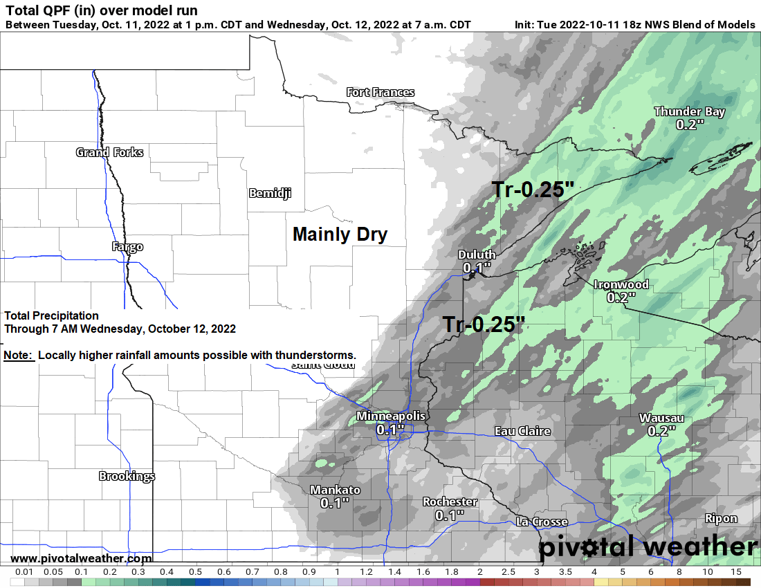
Scattered showers and thunderstorms will develop across parts of the Northland once the aforementioned cap breaks and we get enough forcing to take place ahead of an approaching upper-level trough and cold front. Timing of when we may see storms develop is around 6-8 PM this evening.
There continues to be an isolated risk for strong to severe thunderstorms over northeast and eastern Minnesota and for all of northwest Wisconsin for tonight. The primary severe weather threats include large hail to 1″ in diameter (quarter size) and damaging wind gusts to 60 mph.

20z HRRR model radar forecast valid from 7 PM this evening to 7 AM Wednesday.

Colder 500mb temperatures will move over the Northland on Wednesday with H5 temps decreasing to around -30C — These colder temperatures aloft combined with some warmer air near the surface will cause scattered pop-up showers to develop across the Northland on Wednesday and its possible that we could see a few of the strongest showers produce some small hail and perhaps even a rumble of thunder during the afternoon.
18z NAM 3km model radar forecast valid 12 PM Wednesday to 7 PM Wednesday.

Yes, it was a very warm day across the Northland with highs in the mid 70s to lower 80s, but the highs today were still below the record high temperatures for October 11th — See list below.
International Falls, MN: 88 set in 2015
Hibbing, MN: 87 set in 2015
Ashland, WI: 86 set in 2015
Brainerd, MN: 85 set in 2015
Duluth, MN: 84 set in 2015

Temperatures across Minnesota into much of Wisconsin are running some +15 to +25 degrees warmer than normal this afternoon.

Chances for snow showers or mixed rain/snow showers will increase over the Northland for Thursday and Friday as even colder air settles over the area while thickness values drop as well, and this will support some frozen precipitation at times.
Here’s the 18z NAM 3km model radar forecast valid from 1 AM Thursday to 1 AM Friday
Snow (blue)
Rain (green)

A light coating of snow accumulation is possible across much of northern Minnesota Thursday and Friday, and some minor snow accumulation is also possible over parts of northwest Wisconsin.
Snow amounts through Friday should remain <1″, but there is a chance if a more persistent band of snow showers develops while setting up over the same location for there to be an inch or so of snow accumulation, again this would be for the Thursday-Friday time period.

Thanks for reading!
Tim
Leave a Reply