5:06 PM Sunday, October 30, 2022
It’s another fantastic fall day in the Northland with temperatures in the upper 50s to low to mid 60s this afternoon.
- Today, October 30th marked the 12th day this month with a high of at least 60 in Duluth (normal in October is 8 days at or above 60) Most was 25 days set in October 1963, and the fewest was 0 set in October 2009 and October 1917. Note: October 2021 had 16 days with a high of at least 60 in Duluth.

There is plenty of cold air sitting well to our north today, but this cold air won’t be able to penetrate very far to the south, yet. But there are indications in model guidance for at least some of this cold air to start pushing farther and farther south/east beginning later this week and into next week, with some of this cold air possibly affecting the Northland after November 3rd. How cold and for how long is uncertain at this time.

| Record or near record warmth is possible in the Northland this week, with Tuesday and Wednesday looking like the two days with the greatest chances for a few new record highs to be set in the Northland. Record Highs for November 1st Ashland, WI: 74 set in 1933 Brainerd, MN: 69 set in 1990 and 1944 Hibbing, MN: 69 set in 1990 Duluth, MN: 68 set in 1990 International Falls, MN: 65 set in 1990 Record Highs for November 2nd Duluth, MN: 71 set in 1903 Ashland, WI: 70 set in 1944 and 1938 International Falls, MN: 67 set in 1978 Hibbing, MN: 66 set in 1978 Brainerd, MN: 65 set in 2015, 1981 and 1917 |
The pattern this week will feature a trough with lower 500mb heights covering the western U.S., while upper-level ridging with higher 500mb heights covers the Great Lakes and eastern U.S.

A cold front moving east late this week could bring some precipitation to the Northland from Thursday evening through Friday morning.
Rain looks to be the main precipitation type at this time due to a lack of cold air, but we could see enough cold air build into northern Minnesota allowing for a rain/snow mix for a time early Friday morning, but widespread significant snow accumulations are not expected late this week.

EPS model probability for >0.1″ snowfall for late this week.

We may see some changes in the 500mb pattern next week as a trough sets up from the Pacific northwest into central Canada while a ridge covers areas from the southern to eastern U.S.
With winds aloft coming out of the NW in western and central Canada next week this may allow for some cold air to push far enough south into the Northland at times.

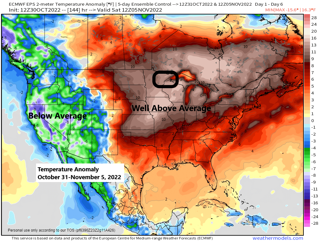
The temperature pattern for next week reflects the changes in the upper-level pattern above, although it looks like the coldest temperatures compared to average will remain over western Canada into the Northern Rockies next week.

Thanks for reading!
Tim
Leave a Reply