5:40 PM Monday, October 31, 2022
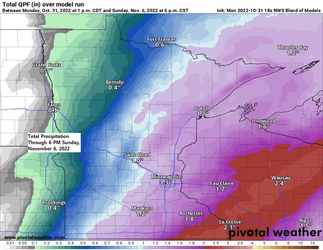
There is a chance the Northland will be impacted by 3 low pressure systems by the middle of next week.
-The first system comes through late Thursday into early Friday in the form of a cold front, and this front will likely bring some rain to northeast Minnesota and northwest Wisconsin late in the week, but a lack of cold air means that will see very little to no wintry precipitation with this first system.
-A second system (more complex than the first) could impact the Northland this weekend bringing another round of rain and maybe a little snow to the area Saturday and Sunday, but there is a lot of uncertainty on the track of this system, and how much phasing occurs between a trough approaching from the NW, and a surface low lifting NE out of the southern Plains. If we get quite a bit of phasing to occur, then a very deep surface low (<980mb) would pass through the upper Midwest and Great Lakes this weekend, but if this system remains largely unphased, then a weaker system would result.
-A third system could impact the Northland early next week (~November 7-9) and this one may have colder air to work with bringing more of a wintry precipitation threat to much of the area.
In the end we’re looking at above normal precipitation across the Northland late this week into early next week.

It was a very mild Halloween in the Northland with widespread 60s for daytime highs.
- High of 63 at Duluth today – Last time it was 60 or warmer on Halloween was in 2000.
- Halloween 2022 was the warmest Halloween in Duluth since 1958 (high of 64)
- Warmest Halloween on record at Duluth was in 1950 with a high of 74.

Thanks for reading!
Tim
Leave a Reply