8:03 PM Saturday, November 26, 2022
Cooler temperatures are on the way, although we’re not looking at any arctic air masses impacting the Northland until sometime later next week, and even then, the arctic air looks pretty transient, but a more prolonged stretch of arctic air is possible around or after December 4.
Highs Sunday and Monday will mainly be in the 30s in northeast Minnesota and northwest Wisconsin which is much closer to normal compared to the 40s and 50s we’ve seen the past few days.
Two systems of interest early to mid-next week.
The first system (clipper origins) passes north of our area on Monday with southerly winds and warm air advection ahead of this system producing an area of mostly light snows across northern Minnesota into the Arrowhead.
The greatest chances for around an inch of snow on Monday covers far northern Minnesota (black outlined area on map)
Less than an inch of snow is expected in Duluth on Monday.

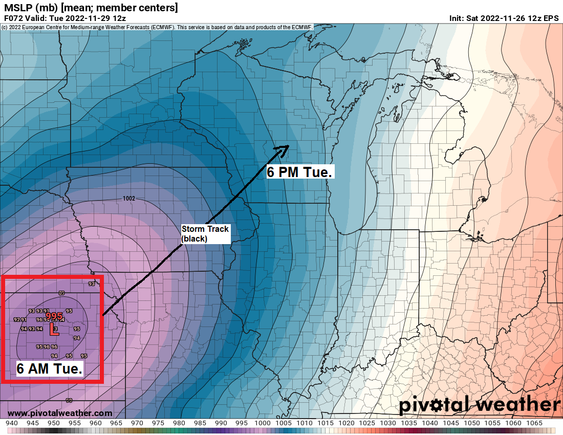
A larger system could impact portions of the upper Midwest and western Great Lakes Tuesday through early Wednesday.
There remains some uncertainty on how this system will evolve since it will consist of a few different pieces of energy, with one low moving ENE out of Colorado, while another low moves east out of southern Manitoba. How much phasing occurs with the two lows is uncertain, but it is looking pretty likely that will see an area of accumulating snow regardless of whether or not this system phases and reaches its full potential or remains less phased and somewhat weaker.
An area from southern to eastern Minnesota into western and northern Wisconsin have the greatest chance for seeing accumulating snow which could range from 2 to 4+” on Tuesday based on model guidance from today (Saturday)
Here is my preliminary snowfall forecast for Tuesday’s event, but some changes to my forecast are likely over the next few days.

50-degree temperatures in parts of the Northland today (Saturday, November 26, 2022)
Note – No new record highs were set in the Northland today, but Ashland, Brainerd and Hibbing did come within 3 degrees of tying their record high temperature for November 26.
*Today’s high of 50 at the Duluth Airport is the warmest temperature since November 3, high of 64.
High Temperature reports for November 26, 2022
Ashland, WI: 56 F
Hayward, WI: 55 F
Superior, WI: 54 F
Brainerd, MN: 53 F
Siren, WI: 53 F
Duluth Sky Harbor Airport: 52 F
Two Harbors, MN: 52 F
Aitkin, MN: 52 F
Moose Lake, MN: 52 F
Hinckley, MN: 50 F
Duluth, MN (Airport) 50 F
Solon Springs, WI: 50 F
Thanks for reading!
Tim
Leave a Reply