4:53 PM Tuesday, December 27, 2022
An active weather pattern is in place as several storm systems affect the western U.S. over the next few days. A few of these systems could affect the Northland through the middle of next week, although chances that a major winter storm/precipitation event hitting our area look pretty low for the rest of this week, but as we get into early to mid-next week there is a chance for a more significant system impacting the upper Midwest, but that system of interest is still a good 5-7 days out so things will likely change in model guidance from what they show today.
Goes-16 water vapor loop from Tuesday, December 28, 2022 (loop time ends 4 PM CT)

Patchy light snow, and freezing rain/drizzle is possible at times across northeast Minnesota and northwest Wisconsin tonight and Wednesday, but no major impacts are expected, and what the forecast radar is showing is probably a bit overdone in terms of the aerial coverage of precipitation through early Wednesday evening.
18z NAM 3km model radar forecast through 6 PM Wednesday.
Snow (blue)
Wintry mix (pink and purple)

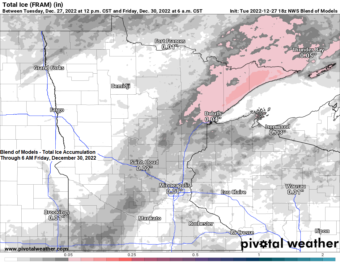
There is a chance for some light snow, rain, and patchy freezing rain across the Northland Wednesday night through early Friday morning, but this doesn’t look like it’ll be a significant snow or ice event for our area.
The setup includes two systems, one approaching from Manitoba, while another system lifts northeast out of the Central Plains. This system doesn’t phase which will likely limit the amount of precipitation we see in the Northland.

20 member GEFS model snowfall forecast through 6 AM Friday, December 30, 2022
A narrow strip of snow is possible somewhere across the upper Midwest Thursday into early Friday, but as you can see there is uncertainty on where that narrow band of snow sets up, with one member having it across southern to northeast Minnesota and western Wisconsin (3), to western Minnesota (7), to southern Minnesota/west-central Wisconsin (13) but regardless of where this band of snow is, it doesn’t look like it’ll be a major snow event.

Snowfall accumulations of an inch or less are possible in much of the Northland Thursday into early Friday.

Here’s what I’m watching for early next week.
A stronger trough digging south through the Rockies with a big ridge farther to the east.
We should see a storm spin up across the central/southern Rockies given the pattern the models are currently showing for early next week but of course the storm track this far out is far from certain, as are precipitation types should this storm affect the Northland.

Temperatures continue to warm across the region today with 850mb temperatures (~5000 feet in the atmosphere) ranging from around 0C in northern Minnesota to as warm as +18C in southern South Dakota.

Here’s a look at the surface temperatures from late Tuesday afternoon.
40s and even some 50s in parts of South Dakota and in much of Nebraska this afternoon with widespread teens and 20s in Minnesota and Wisconsin.

Temperature stats for 2022 (thru December 26th)
Average temperatures for 2022 are running about -1.0 to -2.0 degrees colder than average in northeast Minnesota and northwest Wisconsin — See below.
Hibbing, MN: 35.7 F; -1.6 degrees below average
Duluth, MN: 39.0 F; -2.0 degrees below average
Ashland, WI: 40.5 F; -1.4 degrees below average
Superior, WI: 40.7 F; -1.3 degrees below average
Brainerd, MN: 41.9 F; -0.7 degrees below average
Note: Average temperatures in the Northland for 2022 are running about -4.0 degrees colder compared to the average temperatures observed in 2021.

Currently northeast Minnesota is having its 6th coldest year on record by climate district.
Temperature rankings by climate district for 2022 (thru December 26th)

Thanks for reading!
Tim
Leave a Reply