5:54 PM Tuesday, June 20, 2023
A very warm and dry pattern will continue in the Northland on Wednesday, but changes are on the way as we begin to break out of this unusually long stretch of dry weather which has impacted a large portion of the Northland for several weeks to as long as a month!
There’s only been two measurable rainfall events (0.01″ or greater accumulation) so far this month in Duluth, those occurred on June 5th with 0.04″ of rain, and on June 19th with 0.01″ of rain.
May 18th was the last time the Duluth Airport recorded at least a quarter inch of rain with 0.27″ of rain, so it’s been over a month now.
June 2023 probably won’t end up as a top 10 driest June on record in Duluth if the computer models end up verifying with a much wetter look in model data for the rest of this month starting this weekend, so will see what happens. As they say, time will tell!
Scattered showers and a few thunderstorms will be possible as soon as Thursday or Thursday night mainly across northern Minnesota, and the chances for scattered showers and a few thunderstorms will spread farther south/east on Friday. This rain will be tied with a cold frontal boundary which will move through the Northland late this week.
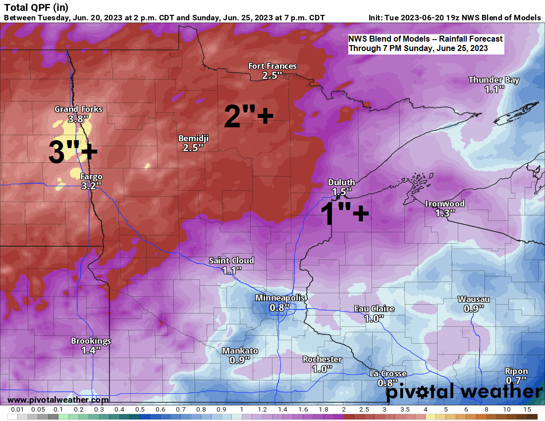
As we get into this weekend will see a larger scale trough with greater amounts of lift move east out of the Northern Plains while the cold front which moves through the area late this week stalls out south of the Northland. We should see a few rounds of more widespread rain and scattered thunderstorm activity in the Northland this weekend due to the approaching trough and surface boundary near the area, and scattered rains could linger even into next Monday on the backside of the system moving through this weekend.
Note — The threat for severe thunderstorms is very low in northeast Minnesota and northwest Wisconsin from Thursday through this weekend as all the parameters needed for severe storms don’t really line up, but isolated stronger storms will be possible. Heavy rain will likely end up being the primary hazard from thunderstorms late this week and this weekend.
For the Duluth area — It looks like will stay dry through Thursday evening but chances for scattered showers and isolated thunderstorms increase Thursday night and through the day on Friday, with additional rounds of rain expected over the weekend.
Here’s the NAM 3km model radar forecast valid from 7 AM Thursday to 1 AM Friday.

A strong upper-level ridge stretched from Texas to Lake Superior today with 500mb heights of around 595 meters associated with the ridge over Texas, and around 590 meters with the northern ridge over Lake Superior.
Upper-level troughs were located over the northwest U.S., and across the eastern U.S. today.

It was a very warm mid-June day if you were away from Lake Superior today with highs in the upper 80s to lower 90s in the Northland, but no record highs were tied or broken today.
East winds coming off Lake Superior kept temperatures in the 60s closer to Lake Superior today.

Tim
Leave a Reply