5:55 PM Wednesday, June 21, 2023
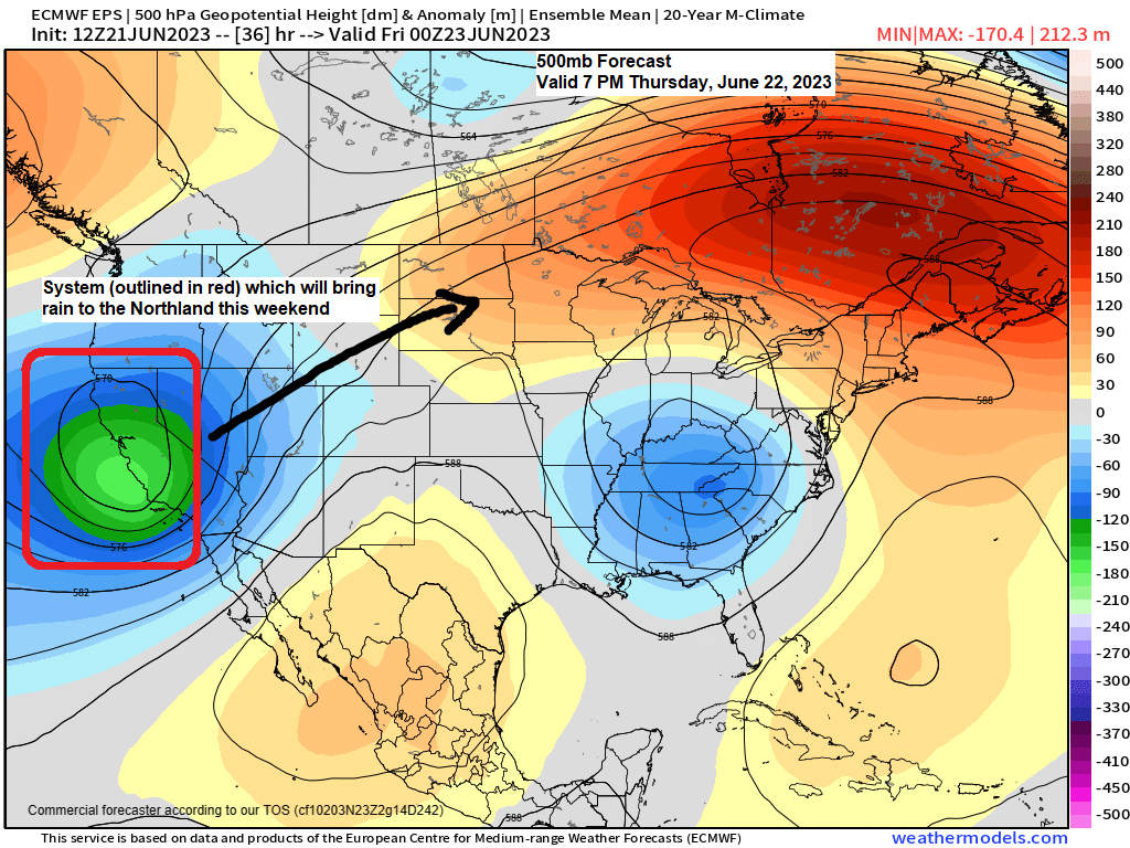
A strong upper-level trough and area of low pressure will be moving into California over the next 24 hours. This system will lift northeast passing over the upper Midwest on Sunday, and then will see this system exit off to the east on Monday.
A widespread rain is likely in northeast Minnesota and northwest Wisconsin this weekend with some breaks in the rain likely both days.
Prior to this weekend there is a cold front which will move slowly east out of western Minnesota for Thursday and Friday, and we should see some scattered showers and a few thunderstorms accompany this frontal boundary as it moves into the Northland Thursday night into Friday. Note — Rain chances on Thursday is highest across north-central Minnesota, and then will see the greater chances for some scattered rains shifting a little further south for Friday.
Here’s the 500mb forecast valid from June 22 to June 26, 2023.

Rainfall totals of 1 to 2 inches or more are still possible through Sunday evening across northeast Minnesota and northwest Wisconsin. Note — Most of this rain will fall over the weekend, but scattered rains are likely Thursday night and Friday.

12z NAM 3km model radar forecast valid from 7 AM Thursday to 7 AM Friday.
Note — It looks like will stay dry in Duluth Thursday and Thursday night.

Still no changes in the overall weather pattern today with strong upper-level ridging across the southern Plains and over the Great Lakes into eastern Canada with a deep upper-level trough over the western U.S., and in the eastern U.S.

90-degree temperatures as far north as the south shore of James Bay Canada this afternoon while much of Texas continues to bake with temperatures well into the 100s once again today.

Temperatures were running around +15 to +25 degrees warmer than average this afternoon across the upper Midwest and in central/eastern Canada, and also in western/southern Texas.

A closer look at temperatures in the Northland from Wednesday afternoon.
Very warm temperatures inland from Lake Superior once again this afternoon while a stubborn east wind keeps it cooler by the lake.
Note — Highs Thursday will be very similar to what we saw today, although the lake breeze might not be as efficient at keeping it a whole lot cooler near Lake Superior on Thursday, will see what happens.
Today’s high of 81 at the Duluth Airport makes this the 5th day this month with a high of at least 80 degrees. Duluth averages 5 days in the month of June with a high of at least 80 degrees.

A wetter pattern looks like it will continue into early July across the area with multiple shots to get some rain.
Our current drought which is impacting Minnesota and Wisconsin could be improving quite a bit over the next 2 weeks if these computer model forecasts end up verifying.
Here are the ensemble model rainfall forecasts through July 6, 2023.


Tim
Leave a Reply