5:31 PM Thursday, June 22, 2023
Not a real surprise that we continue to see the drought expand and worsen across the area given the severe lack of rain in much of the area, but changes are coming as we enter a wetter pattern which could have some staying power, so we should begin to see this drought improve a bit during the next 1 to 2 weeks, but for now things aren’t looking too good.
Rainfall Anomalies for June 2023 (thru 4 PM on the 22nd)
Duluth, MN: -3.01″ below normal
Brainerd, MN: -2.66″ below normal
Ashland, WI: -2.63″ below normal
Hibbing, MN: -2.37″ below normal
International Falls, MN: -2.17″ below normal
Note — Duluth has only seen 1% of its normal rainfall this month (thru the 22nd) with only 0.05 inches of rain at the Airport.
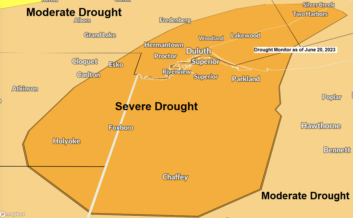
Here’s the latest drought monitor as of June 20, 2023.
Minnesota
4% of the state is in Severe Drought, up from 2% last week.
39% of the state is in Moderate Drought, up from 18% last week.
92% of the state is Abnormally Dry, up from 77% last week.


Wisconsin
7% of the state is in Severe Drought, up from 0% last week.
78% of the state is in Moderate Drought, up from 46% last week.
100% of Wisconsin is Abnormally Dry, up from 90% last week.

4 week drought monitor change (June 20, 2023, compared to May 23, 2023)
Drought has worsened by 2 or 3 classes over the last few weeks in the darker orange areas on the map.

2% of the Midwest is in Extreme Drought, up from 1% last week.
15% of the Midwest is in Severe Drought, up from 7% last week.
58% of the Midwest is in Moderate Drought, up from 48% last week.
92% of the Midwest is Abnormally Dry, up from 89% last week.

A cold front will move slowly south/east across the Northland tonight and Friday bringing scattered showers and a few thunderstorms to the area.
Rain chances tonight are highest in northern Minnesota, then on Friday we should see a greater chance for scattered showers and storms shift a little farther south to include east central Minnesota and northwest Wisconsin.
Note — Will stay dry in Duluth tonight followed by a chance for scattered showers on Friday, but the key word is scattered. A more widespread rain event is still expected this weekend.
NAM 3km model radar forecast through 7 AM Saturday.

Widespread rainfall totals of 1 to 2 inches or more are forecast in all of northeast Minnesota and northwest Wisconsin through 7 PM Sunday.

***FLASH FLOOD POTENTIAL SATURDAY***
The setup for Saturday/Saturday night does favor the development for excessive rainfall as we could see thunderstorms train over the same location which increases the risk for flash flooding. Currently the risk for some flooding is greatest in the yellow area on the map below.

***WILDFIRE SMOKE***
Another round of potentially impactful surface smoke moves into northern Minnesota on Friday, and then this smoke pushes farther west and south to impact the Twin Ports on Saturday.
HRRR model near-surface smoke forecast valid from 7 AM Friday to 1 PM Saturday.
High levels of ground level smoke in orange, red and purple on the animation below.

Tim
Leave a Reply