6:27 PM Friday, August 4, 2023
Will it rain, or won’t it? That is the question.
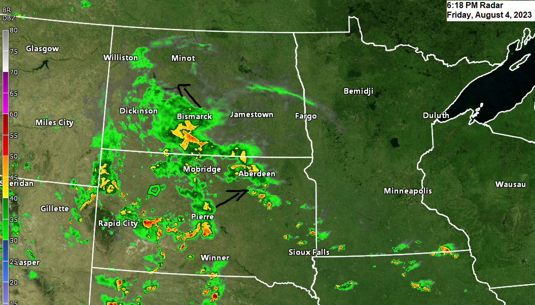
System which could bring some rain to the Northland this weekend is currently centered over the Dakotas this afternoon where there’s been heavy rain showers with embedded thunderstorms especially over the central/western portions of North and South Dakota.
This will be a slow-moving system with it not exiting off to the east of the Northland until sometime Sunday night, but where the main area/s of rain sets up is still very uncertain this afternoon, although there are some trends showing up indicating that there could be two main swaths of more substantial rains, one across north central Minnesota, the other possibly over far southern portions of northwest Wisconsin, while locations near Lake Superior including the Twin Ports may not see much rain at all as the main areas of rain set up west/north, and also southeast of the Twin Ports and the Lake Superior region from Saturday night through Sunday.
There could be a few rain showers around late tonight into early Saturday afternoon over western/southern portions of the Northland (west/south of Duluth) but these should diminish Saturday afternoon.
Rainfall forecast from the European computer model.

Nam 3km model radar forecast valid 7 AM Saturday to 7 AM Sunday.
Much of the rain Saturday and Saturday night looks to be from the eastern Dakotas, and from southwest to west central and northwest Minnesota with not much rain expected east of that area.

And here’s an early look at Sunday which shows the rain basically falling apart as it moves farther east out of western and northern Minnesota Sunday morning, at least how the NAM 3km model sees things this afternoon.

A look at the system that will move across the upper Midwest this weekend.
Radar loop ending 5:05 PM CT, Friday, August 4, 2023.

Goes-16 water vapor loop from Friday, August 4, 2023 (loop time ends 5:01 PM CT)

Goes-16 visible satellite loop from Friday, August 4, 2023 (loop time ends 5:01 PM CT)

Thanks for reading!
Tim
Leave a Reply