4:23 PM Tuesday, September 19, 2023
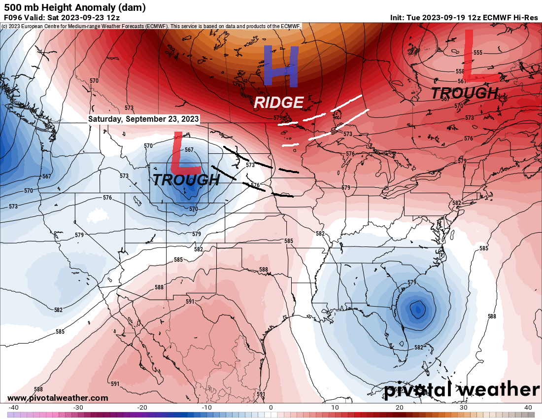
A complicated forecast ahead as will be dealing with the effects of a building upper-level ridge to the north of Minnesota while an upper-level low/trough moves east out of the northern Rockies late this week through early next week. How much rain we see in the Northland this weekend and early next week will depend on how far north/east that aforementioned low/trough tracks, and the computer models today have shown a slightly farther south track to this system which could ultimately lead to less rain in much of the Northland this weekend and early next week.
One of the key features to watch this weekend is that high (blue H on map) sitting over northern Ontario, this high will likely advect some drier air southward out of Canada and down Lake Superior, but how far south is the question, because at the same time this is happening, will see that area of low pressure (red L on map) pump moisture northward leading to some rain this weekend, but how far north the rain gets is uncertain right now.
Here’s the forecast map for Saturday

Ensemble model forecasts of total rainfall through 7 PM Sunday.


A few showers or thunderstorms could occur at times in parts of the Northland tonight through Friday, this is due to a frontal boundary which will setup up over western into northern Minnesota the next few days, but the amount of lift near this front looks pretty weak so widespread rains are not expected over the next few days, and the rainfall patterns will probably be pretty chaotic if anything develops at all.
Here’s the NAM 3km model radar forecast from Midnight tonight to 7 PM Wednesday.

Very warm temperatures continued today away from Lake Superior with 70s and 80s widespread in much of Minnesota and the Dakotas with even a few locations reporting temperatures of 90 degrees this afternoon.
Persistent east winds are keeping temperatures quite a bit cooler once again today near Lake Superior with temperatures this afternoon mainly in the 60s.

Thanks for reading!
Tim
Leave a Reply