5:37 PM Wednesday, October 4, 2023
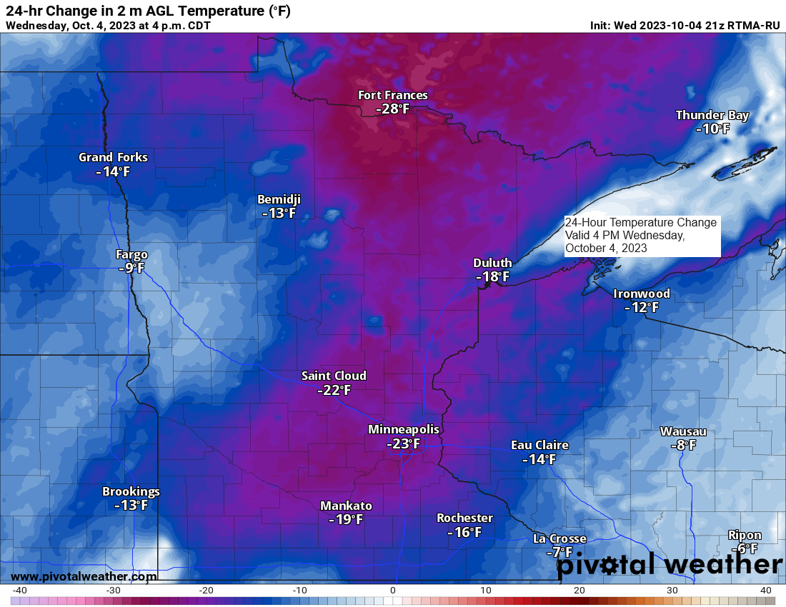
Cooler temperatures arrived in the Northland today and this cooler weather pattern will likely continue through this weekend and possibly even into early next week.
An upper level low and upper trough will become established over the Great Lakes, southeast Canada and the northeast U.S. over the next few days, and this new pattern will likely carry over into much of next week.
With the low to our east and high pressure to the northwest, this sets up a northwest to north-northwest flow aloft across the Northland over the next several days which means that will see much cooler temperatures in northeast Minnesota and northwest Wisconsin for the rest of this week and into at least early next week.
Along with these cooler temperatures will come some more rain showers at times from tonight through Friday as two more fronts cross the Northland. However, temperatures still look warm enough for this precipitation to be in the form of rain in our area.
500mb forecast from the Euro ensemble model.

NAM 3km model radar forecast through 7 AM Friday.

Total precipitation forecast through 7 PM Friday.

Temperatures across the Northland for next week have been trending cooler compared to how they looked a few days ago.
We definitely won’t be seeing anymore 70s in our area through much of next week. Instead, it looks like will be seeing highs mostly in the 50s with maybe a few 60s on a day or two in some parts of the Northland.
Temperature anomaly forecast for next week via Euro ensemble model.

And here’s the GEFS model temperature anomaly trend for next week (Oct. 9-14, 2023)
Newest run is Days 6-10, and the oldest run is Days 8-12 on the loop below.
Note how the deeper reds (warmer than average temps) are vanishing in the Northland for next week as temperatures trend cooler.

For those looking for some early season snows, well parts of southern/eastern Ontario and southwest Quebec could be the spots that see some accumulating snow late Sunday into Monday.

Here’s a look at the MRMS precipitation analysis over the past 24 hours ending 8 AM Wednesday. Greatest rainfall amounts in the Northland last night were over north central Minnesota or right where they were forecasted to be with lesser amounts of the rain farther east.

24-Hour Rainfall Reports ending 1 PM October 4, 2023
Source: MesoWest; National Weather Service Duluth, MN
Walker, MN 3.0 SSE: 1.46″
Backus, MN 5.9 W: 1.22″
International Falls, MN: 1.06″
Littlefork, MN: 1.05″
Bigfork, MN: 0.58″
Deer River, MN: 0.53″
Hill City, MN: 0.46″
Brainerd, MN: 0.45″
Walker, MN: 0.43″
Northome, MN: 0.41″
McGregor, MN: 0.39″
Chisholm-Hibbing Airport: 0.36″
Cass Lake, MN: 0.30″
Grand Rapids, MN: 0.26″
Orr, MN: 0.26″
Embarrass, MN: 0.16″
Moose Lake, MN: 0.14″
Saginaw, MN: 0.13″
Eveleth-Virginia, MN: 0.10″
Schroeder, MN: 0.10″
Oliver, WI 2.8 NE: 0.10″
Webb Lake, WI: 0.10″
French River, MN: 0.08″
Wolf Ridge, MN: 0.07″
Danbury, WI: 0.06″
Hinckley, MN: 0.06″
Duluth Airport: 0.05″
Esko, MN: 0.04″
Siren, WI: 0.04″
Solon Springs, WI: 0.03″
Wrenshall, MN: 0.03″
Duluth Sky Harbor Airport: 0.03″
Hayward, WI: 0.03″
Ely, MN: 0.03″
Minong, WI: 0.02″
Washburn, WI: 0.02″
Thanks for reading!
Tim
Leave a Reply