5:21 PM Thursday, October 5, 2023
Pattern change is well underway today as a couple of upper lows dig south/southeast across central Canada along with an upper-level trough.
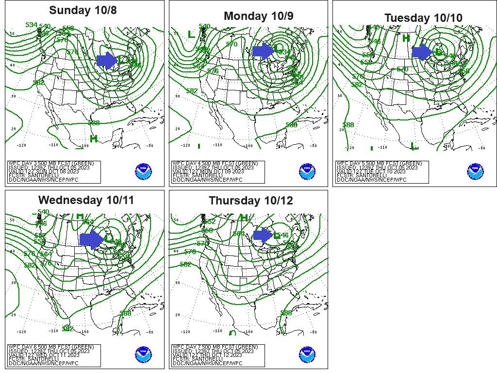
The pattern going forward will feature a persistent and deep upper-level trough over eastern Canada, the eastern U.S. and Great Lakes with a north-northwest flow aloft over the upper Midwest on the backside of the aforementioned trough. This pattern configuration will keep a cool airmass in place in the Northland through much of next week with daytime temperatures in the mid 40s to low-mid 50s while overnight temperatures fall into the 30s to around 40 with some 20s possible on nights where we get enough clearing to occur.
Colder temperatures continue to move south/east into the Northland today with temperatures mainly in the 50s to lower 60s, but passing gusty showers helped to drop temperatures into the mid to upper 40s at times across northern Minnesota.

Colder air aloft consisting of 500mb temperatures around -26C combined with the little heating we had near the surface made the atmosphere a little unstable today, and as a result we saw numerous scattered coverage showers and a few thunderstorms move across the Northland today with brief heavy downpours along with a couple reports of small hail of mostly pea size. Note — Rainfall amounts across the Northland today have generally been <0.10 inches with a few locations getting up to a quarter inch of rain.
Strong winds have also occurred with these showers today — Here are some wind reports from today. Source: National Weather Service Duluth, Minnesota.
1:41 PM: Thunderstorm Wind Gust 54 mph. 1 S Grand Marais, MN — Cook County.
1:20 PM: Thunderstorm Wind Gust 66 mph. 26 SE Lutsen, MN — Ship report Clyde E. VanEnkevort.
1:11 PM: Thunderstorm Wind Gust 63 mph. 18 SSE Lutsen, MN — Ship report Algoma Niagara.
12:30 PM: Thunderstorm Wind Gust 57 mph. 1 SSE Silver Bay, MN — Lake County.
Radar loop from Thursday, October 5, 2023 (loop time ends 4:40 PM CT)

We’ve seen several Special Marine Warnings issued for parts of Lake Superior today, and there’s even been a chance for waterspouts on Lake Superior today due to favorable atmospheric conditions to support a waterspout threat, and these favorable conditions for waterspouts will linger through Friday morning.
Here’s the radar image from 1:56 PM this afternoon and the blue outlined area is just one of the many Special Marine Warnings we’ve seen issued for Lake Superior today.

Scattered showers will continue in northeast Minnesota and northwest Wisconsin tonight and Friday, but the coverage of these showers should become less and less by Friday night.
Note — Temperatures should stay warm enough for precipitation to fall as rain in our area tonight and Friday.
NAM 3km model radar forecast through 7 AM Saturday.

NWS Blend of Models total precipitation forecast through Friday evening.

Goes-16 water vapor loop from Thursday, October 5, 2023 (loop time ends 4:30 PM CT)

Thanks for reading!
Tim
Leave a Reply