6:48 PM Monday, October 30, 2023
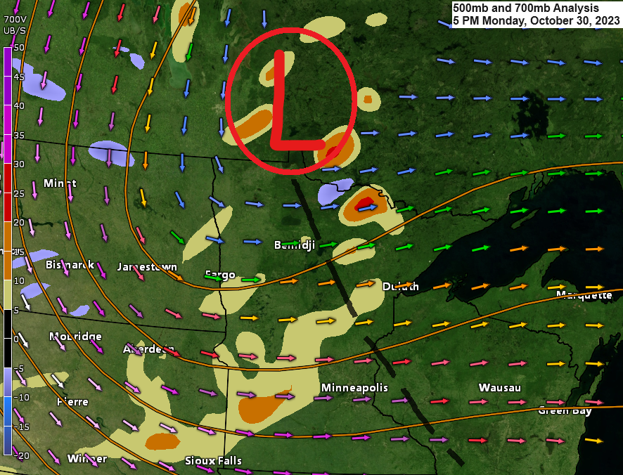
The first widespread snow event of the season will affect much of the Northland tonight into Tuesday morning as a potent upper-level system moves southeast out of southern Manitoba into eastern Minnesota and southwest Wisconsin by around daybreak Tuesday.
-Snowfall totals ranging from around 0.5 inches to 1.5 inches are expected in much of northeast Minnesota and northwest Wisconsin through early Tuesday morning, but there is a potential for higher snow totals of 2 to 4 inches to possibly as much as 5 inches of snow in some locations as we could see heavier snow showers develop in some parts of the Northland tonight into early Tuesday morning, one area which could see these higher snow totals would be along the South Shore of Lake Superior in northern Wisconsin, and possibly over parts of north central and east central Minnesota as well.
-Snow should end from north to south, first in northern Minnesota by later this evening, and then in eastern Minnesota and northern Wisconsin by mid-morning Tuesday.
-Temperatures in the 20s to around 30 tonight, with temperatures Tuesday afternoon in the 30s.
-Blustery winds out of the north to northwest late tonight-Tuesday with wind gusts of 15 to 30 mph.
Here are 2 weather model snowfall forecasts for tonight’s system.
The HRRR model has definitely trended higher with snow totals tonight in northwest Wisconsin and also in parts of northern/eastern Minnesota including in the Twin Ports.

A blended model approach shows snow totals of around 1″ for Duluth tonight with higher totals in parts of northwest Wisconsin, but again this takes into account several different computer models which some show lower snow totals, while others show higher totals, and in the end, this is a blended model approach.

HRRR model radar forecast through 10 AM Tuesday.

Winter Weather Advisory (purple area on map) is in effect late this evening through Noon Tuesday for the south shore of Lake Superior in northwest Wisconsin.
Note — Map last updated 6:47 PM Monday, October 30, 2023.

As lapse rates steepen tonight to around 7.0-0.5 c/km this does raise the possibility of heavy snow showers developing over parts of the Northland tonight into early Tuesday morning.

Goes-16 water vapor loop from Monday, October 30, 2023 (loop time ends 4:50 PM CT)

Note: At least one location in the Northland had a temperature in the single digits Monday morning, with a temperature of 8 degrees reported 3 miles west of Indus, Minnesota.
Low of 10 at Hibbing, Minnesota Monday morning, not a record for October 30th (record low is 6 set in 1988), but still well below average for late October.
Low of 15 at the Duluth Airport Monday morning, this type of cold is more typical of late November or early December as the normal low in Duluth doesn’t reach 15 degrees until December 1st!
TEMPERATURE TRENDS
Below average temperatures are likely to continue in the Northland this week.

There is a little more uncertainty with the temperature forecast next week, although at least for the moment both the EPS and GEFS models continue to show below average temps across the Northland.

GEFS model temperature anomaly trend for next week (November 6-11, 2023)
Oldest run is Days 12-16 on the animation below, and the newest run is Days 8-12.
Below average temps in blues
Above average temps in orange/reds

Thanks for reading!
Tim
Leave a Reply