5:56 PM Monday, January 22, 2024
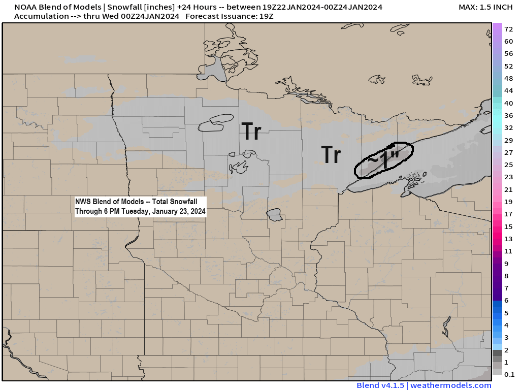
A few snow showers and flurries are possible tonight across northern Minnesota with snow accumulations less than an inch.
On Tuesday will have east winds coming off Lake Superior which could cause a few lake effect snow showers along the North Shore of Lake Superior but with only a marginally cold airmass in place any lake effect snow shouldn’t amount to much with snow amounts maxing out at an inch at most.
9.1 inches of snow so far this month in Duluth and we probably won’t add much more snow to that total the rest of this month based on what the computer models are showing. Normal snowfall in January is 16.8 inches.
Snow depth of 6 inches at the Duluth Airport. Last year on January 22nd the snow depth was 24 inches.
No arctic air/subzero temperatures expected in Duluth through at least February 5th.
Highs in Duluth mostly in the 30s starting Wednesday of this week and lingering well into next week, with a chance for 40+ degree highs on a few days next week.
Only around 7% of Lake Superior is covered by ice as of January 21st (normal amount in late January is around 20%), and the temperatures ahead don’t look very favorable for making much more ice into early February.

NAM 3km model simulated radar forecast through 6 PM Tuesday.

Well above normal temperatures expected in northeast Minnesota and northwest Wisconsin at least through February 3rd.


A massive upper-level ridge is forecast to develop in central Canada next week with troughs over the Pacific and Atlantic Oceans.
Weather pattern looks pretty quiet in the Northland with the upper ridge near our area next week.

Long Range Snowfall Trends
Look away if you’re a fan of snow, because there isn’t much snow coming to the Northland at least for the rest of this month.
GEFS model 20-member total snowfall through January 31st looks pretty snowless in northeast Minnesota and northwest Wisconsin.
3 out of 20 members show around 2 inches of snow in parts of the Northland through January 31st, the other 17 members show <2 inches of snow the rest of the month.

And the 50-member EPS model total snowfall forecast for Duluth agrees quite nicely with the GEFS model.
4/50 members show at least 2 inches of snow, the other 46 are in that 0.1 inch to 1 inch range.

Thanks for reading!
Tim
Leave a Reply