6:45 PM Tuesday, June 4, 2024
Showers and thunderstorms are expected to persist across the Northland tonight, with the possibility of heavy rainfall through the night, and isolated strong to severe thunderstorms until approximately 8 or 9 PM this evening. As the night progresses, the rain will taper off from west to east, yet it is anticipated to persist the longest in northeast Minnesota, including the Arrowhead region, and in parts of northwest Wisconsin.
Note: Rain should diminish in Duluth later tonight between 1 and 4 AM.
Radar loop ends 6:36 PM Tuesday, June 4, 2024.
HRRR model simulated radar forecast through 10 AM Wednesday.

Rainfall totals ranging from approximately 0.25 to 0.75 inches are expected in the Northland area tonight through early Wednesday morning, with localized areas potentially receiving higher amounts of 1 to 2 inches or more.

This afternoon’s thunderstorms have generated heavy downpours, with radar estimates indicating more than half an inch to over an inch of rain per hour in certain areas of the Northland.

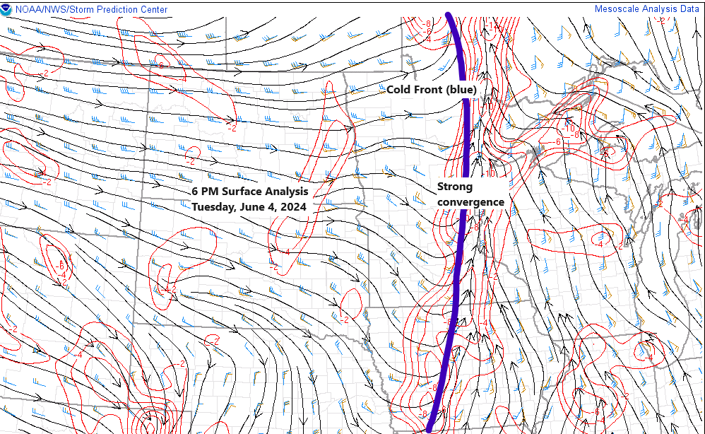
Abundant deep moisture is flowing northward ahead of a cold front moving east today, with precipitable water values reaching as high as 1.30 to 1.60 inches.

-Flood Watch continues until 7 AM Wednesday morning for parts of east central Minnesota including the cities of Walker, Bigfork, Pine River, Brainerd, Hill City, Aitkin, and Grand Rapids.
-Flood Watch continues until 1 PM Wednesday afternoon for northwest Wisconsin and a small part of eastern Minnesota including the cities of Superior, Bayfield, Hurley, Grantsburg, Spooner, Hayward, Ashland, Hinckley, Pine City, and Washburn.
- Flooding caused by excessive rainfall is possible.
- Excessive runoff may result in flooding of rivers, creeks, streams, and other low-lying and flood-prone locations.
- Creeks and streams may rise out of their banks. Low-water crossings may be flooded.

The weather system over eastern Saskatchewan, Canada, is quite significant for this time of year, and another wave is moving northeast across northern Illinois and southern Wisconsin today.
Goes-16 water vapor loop ending 6:00 PM Tuesday, June 4, 2024.

Heading into Wednesday afternoon, the Northland has another opportunity for scattered showers and thunderstorms, prompted by an approaching upper low and cooler temperatures aloft, with an upper-level trough persisting over the region.
Tomorrow’s instability and moisture levels will decrease compared to today, as the frontal system passing through tonight will clear out the greater moisture and instability. However, colder temperatures aloft and steeper mid-level lapse rates are expected for Wednesday afternoon. With sufficient residual moisture and instability, this could lead to additional showers and thunderstorms Wednesday afternoon into the early evening.

Note: Northeast Minnesota and northwest Wisconsin may experience a few strong to severe thunderstorms Wednesday afternoon into the early evening. The primary threat will be damaging wind gusts up to 60 mph, with the possibility of mostly sub-severe hail, less than 1 inch in diameter, also occurring.
HRRR model simulated radar forecast valid 12 PM Wednesday to 12 AM Thursday.

Thanks for reading!
Tim
Leave a Reply