6:25 PM Saturday, March 22, 2025
A messy system arrives late tonight and continues into Sunday.
A variety of precipitation types are likely in the Northland, ranging from wet snow to rain to some freezing rain and sleet. The threat for patchy freezing rain and sleet is highest early Sunday morning, mainly from around 2 AM to 8 AM.
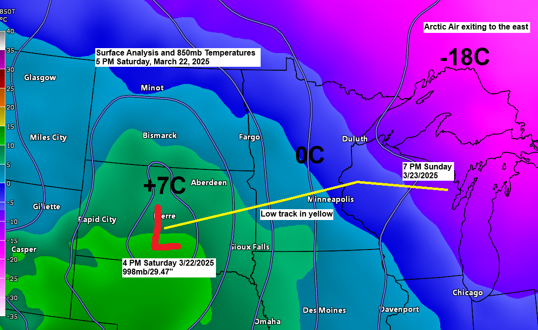
Low pressure bringing us this precipitation is forecast to move out of south-central South Dakota this evening, likely crossing south-central areas of Minnesota Sunday morning, then exiting off to the east-northeast as it cuts across north-central and northeastern Wisconsin by early Sunday evening.
Here’s my updated snowfall forecast as of late Saturday afternoon.
Snow that accumulates should be pretty wet/dense.
Snowfall rates could approach a half inch to an inch per hour at times on Sunday in parts of northeast Minnesota, especially along the North Shore and Arrowhead.

Here’s a look at my updated snowfall forecast for the Duluth metro area for Sunday.
Higher elevations on top of the hill could see between 2 and 4 inches of snow, with generally 1 to 2 inches of snow possible at lower elevations closer to Lake Superior.
I think most of the accumulating snow we see in Duluth may come with that first round of precipitation early Sunday morning when temperatures are below freezing.
Note: Temperatures are forecast to rise to around 32 to 35 degrees by mid to late morning on Sunday and into Sunday afternoon, so even if it’s snowing Sunday afternoon, we may not see much accumulation due to the marginal temperatures, plus the much stronger sun angle at this time of the year.

Ice accumulations of a light glaze to as much as 0.10 inches are possible over parts of the Northland early Sunday morning, mainly before 8 a.m.

Duluth: Precipitation is forecast to begin early Sunday morning around 2 AM. Precipitation ends Sunday late afternoon or during the evening.
NAM 3km model simulated radar forecast valid Midnight tonight to 7 AM Monday.

Winter Weather Headlines
- Winter Storm Warning is in effect from early Sunday morning to Sunday night for the North Shore and Arrowhead of Minnesota.
- A Winter Weather Advisory is in effect from late tonight to Sunday night for much of the rest of the Northland, including all of northwest Wisconsin, Twin Ports, east central, and north central Minnesota.


Here’s a look at the system which will impact the Northland over the next 24 hours or so.
Goes-16 infrared satellite loop ending 5:56 PM CT Saturday, March 22, 2025.

Radar loop ends 5:58 PM CT Saturday, March 22, 2025.
Thanks for reading!
Leave a Reply