In the coming days, a low-pressure system will move northeast from the Rockies across the northern Plains.
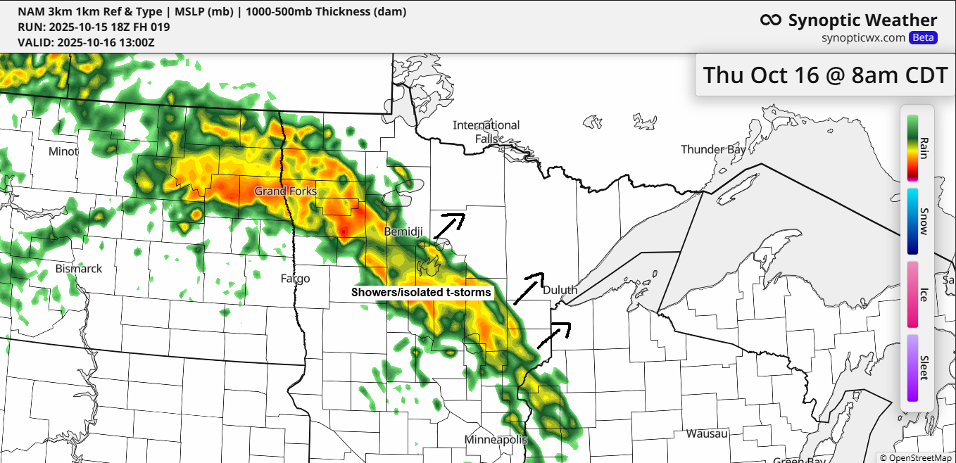
On Thursday, a warm front linked to this system will push northeast out of southern Minnesota, likely bringing occasional showers to northeast Minnesota and northwest Wisconsin. By Friday, a cold front will advance eastward from western Minnesota, though it seems unlikely to bring significant rain, but a few isolated showers are still possible.
There may be some instability over the Northland on Thursday, potentially sparking an isolated thunderstorm, though widespread storms are not expected.
NAM 3km model simulated radar forecast valid 7 AM Thursday to 7 AM Friday.

Rainfall in far northern Minnesota could exceed half an inch on Thursday, while other areas of northeast Minnesota and northwest Wisconsin may see around 0.1 to 0.25 inches, with a chance of some higher amounts.
The heaviest rainfall from this system is expected in eastern Montana and western North Dakota, with 1 to 2 inches or more of rain possible by Friday morning.

The trough-ridge-trough pattern continues today, with the trough over the western U.S. expected to move northeast in the coming days.
Warm air dominates near the ridge across the central and southern U.S. today, while cooler conditions prevail near both troughs.

Goes-16 water vapor loop ending 4:31 PM CT Wednesday, October 15, 2025.

Today, extensive low clouds blanketed the northern Plains and upper Midwest, showing up white in the loop below. Despite this, there were brief moments of sunshine in parts of northeast Minnesota and far northern Wisconsin.
Areas of fog are possible over parts of Northland tonight and Thursday as moisture continues to surge north ahead of an approaching trough.
GOES-19 Day Cloud Phase satellite loop concluding at 4:20 PM CT on Wednesday, October 15, 2025.

This month, Duluth has had 3 days with minimum temperatures of 32 degrees or lower, while the October average is typically 10 days.
Duluth has seen a lack of sustained cold this month, with only three days recording below-average temperatures (blue) and eleven days experiencing above-average temperatures (red).

Leave a Reply