Light rain is expected for a few hours tonight across parts of the Northland, primarily impacting western and southern areas. This rain will be driven by a strong yet compact disturbance moving southeast from eastern North Dakota and northwest Minnesota this afternoon.
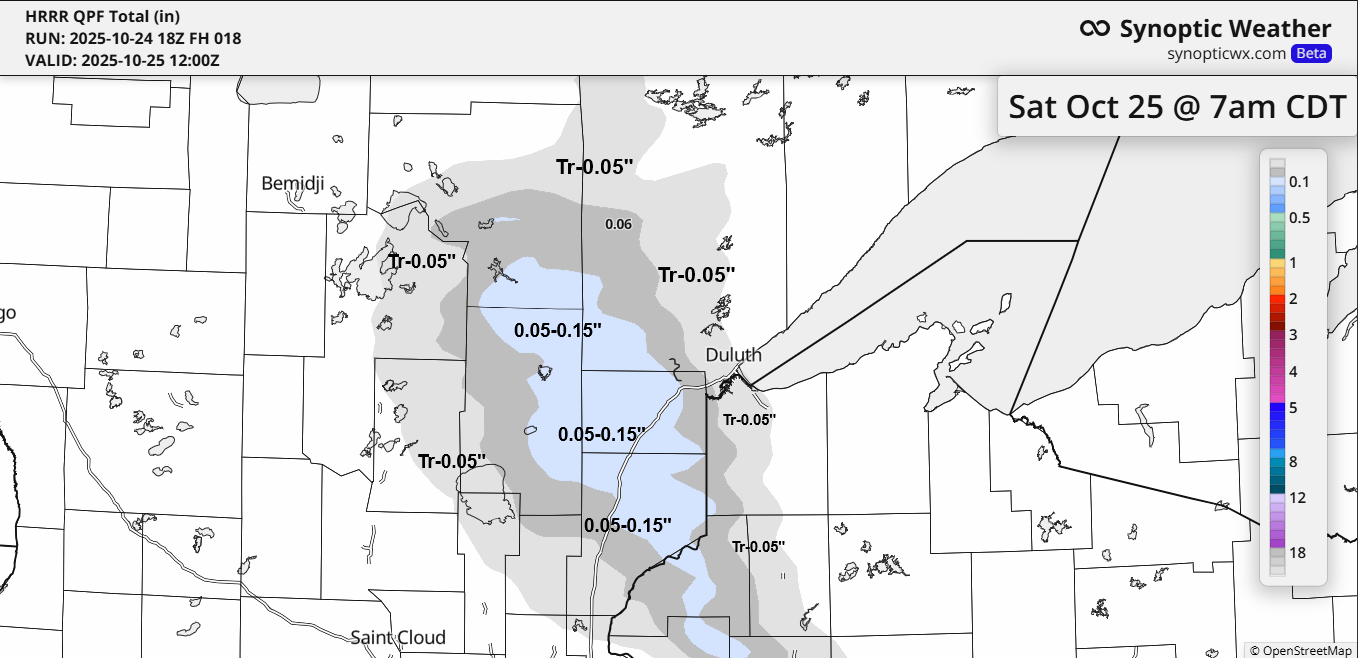
Tonight’s rain totals will range from about 0.05 to 0.15 inches over a small part of the Northland, west and south of Duluth, with trace amounts up to 0.05 inches possible in the Duluth area.
Goes-19 water vapor loop ending 5:20 PM CT Friday, October 24, 2025.

The radar loop concludes at 6:04 PM on Friday, October 24, 2025.
The weather system early to mid-next week is expected to move mostly west and south of the Northland. However, some rain may reach areas from Bigfork to the Brainerd Lakes, including Hinckley and Pine City, potentially bringing about 0.10 to 0.25 inches of rain between Monday and Tuesday. Little to no rain is anticipated east of this area.

Early next week, the system is expected to bypass most of the Northland due to a ridge (blue H on the map) forming over the Great Lakes, while a strong trough (outlined in black) moves through the Rockies. With the ridge nearby, it will likely force the trough and surface low to track south or southeast, instead of moving east or northeast.
Note: As things stand, it seems unlikely that northeast Minnesota or northwest Wisconsin will see any significant precipitation through Halloween, which falls next Friday.

Leave a Reply