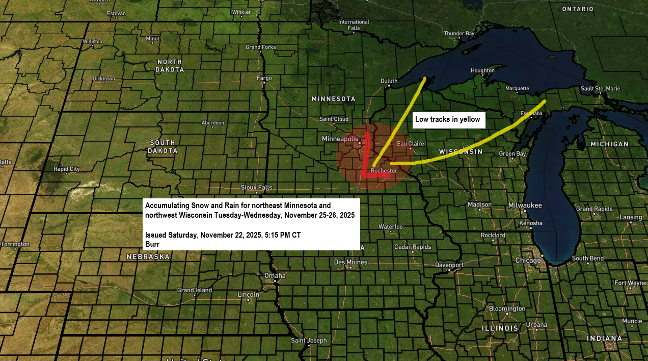
The first widespread accumulating snow event appears to be heading our way this coming Tuesday to Wednesday.
While there’s still some uncertainty in the computer models about the storm’s path—which will determine how quickly rain changes to snow and how long the snow lasts—it’s looking more likely that much of northeast Minnesota and northwest Wisconsin will see at least some snow by Wednesday morning.
Some parts of the Northland could be under a winter storm watch, warning, or advisory on Tuesday and Wednesday if the forecast stays about the same over the next few days.
The system bringing this potential wintry weather is expected to move northeast from southern Minnesota or western Wisconsin on Tuesday morning, reaching eastern parts of Lake Superior by Wednesday morning. A strong mid- and upper-level trough and low are also expected to dip southeast from the northern Plains on Tuesday before heading east by Wednesday.
When rain turns to snow is still up in the air and depends on the path of the low. If it shifts more southeast, colder air could move in sooner, making the switch happen earlier. But if the low doesn’t dip as much, warmer air could linger, pushing the change later. The biggest uncertainty is in northwest Wisconsin, far eastern Minnesota, and up through the Twin Ports and North Shore.
Farther west and north, rain is expected to turn into snow during the day on Tuesday, from the Brainerd Lakes up through the Iron Range and into the International Falls area.
The approaching trough on Tuesday looks quite strong, with signs it could even go into a negative tilt for a while. This should bring some decent lift and possibly heavier precipitation later in the day and into Tuesday night in parts of the Northland.
Here’s a look at the Euro model 500mb forecast valid 6 AM Tuesday to 6 AM Wednesday.

Here’s a look at the GEFS model forecast from 20 ensemble members for precipitation types, valid at 6 PM on Tuesday, November 25, 2025.
Rain: Green
Snow: Blue

After Thanksgiving will be another period to watch, as the pattern suggests more wintry weather could develop somewhere from the Midwest to the Great Lakes. There’s still a lot of uncertainty in the computer models about exactly where this active pattern will set up, but the general trend of colder air moving into the Rockies and northern Plains, combined with warmer air across the southern U.S. toward the Ohio Valley, will likely spark some active weather. Whether northeast Minnesota or northwest Wisconsin will be affected is still a wait-and-see situation.

Leave a Reply