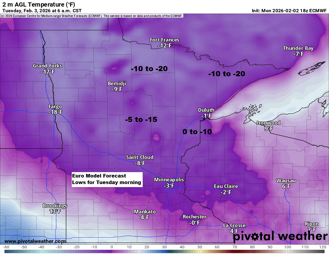
It’s going to be a cold night in the Northland as temperatures will drop between the single digits and 20s below zero in much of the area. Wind shouldn’t be much of an issue, though.
It’ll stay chilly on Tuesday and Wednesday, with highs in the teens and a few spots reaching the 20s on Wednesday. A quick warm-up arrives Thursday, pushing temperatures well into the 30s across much of northeast Minnesota and northwest Wisconsin.

The Northland can expect minimal snow over the next few days, with a chance of light snow showers late Tuesday night into early Wednesday morning, and again early Thursday morning. Any snowfall should only lead to trace amounts of accumulation.
NAM 3km model simulated radar forecast valid 7 PM Tuesday to 12 AM Thursday.

Note: Computer models are hinting at a potential shift in the weather pattern next week, which might bring one or two systems capable of producing snow or other forms of precipitation in northeast Minnesota and northwest Wisconsin. Nothing is certain yet, so for now it’s all about keeping an eye on the model trends to see if this change actually happens. Stay tuned.
Leave a Reply