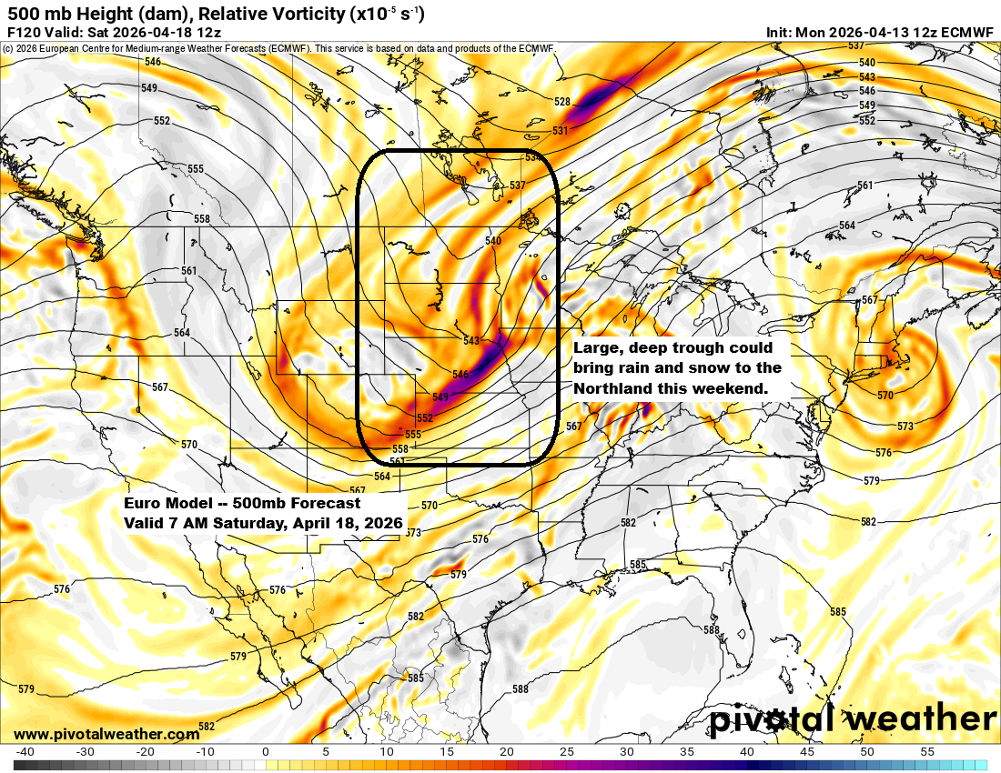
Later this week into the weekend, a large and possibly deep trough could move over the upper Midwest and western Great Lakes. At first, the Northland will be on the warmer side, east of the trough, with some rain possible Friday and Friday night. By Saturday, much colder air is expected to move in as the trough shifts east. It’s uncertain how much moisture will linger in that cold air, but there’s at least some chance for snow in parts of the Northland from Saturday into early Sunday. Some recent computer model runs have hinted at a significant winter storm for the area, but the models have been inconsistent, so the likelihood of a major storm this weekend seems low.
Over the next few days, highs in the Northland will be in the 50s and 60s, with 70s possible by Thursday and maybe sticking around into Friday.
Temperatures will be much cooler, in the 30s and 40s, near Lake Superior over the next few days due to persistent easterly winds. Some fog is also likely at times along the lake this week.
…Severe Thunderstorms tonight…
It’s a busy evening with severe thunderstorms sweeping through southern Minnesota into southwest and central Wisconsin, with a tornado watch in place until late Monday evening. The watch also stretches into far northern Iowa.

This afternoon, storms in southern Minnesota and stretching into southwest and central Wisconsin have mainly brought large, damaging hail, with reports of stones measuring 2 to 3 inches across—ranging from the size of a hen’s egg to even bigger than a baseball.
Radar loop ends 4:56 PM CT Monday, April 13, 2026.
GOES-19 visible satellite loop with lightning flash extent overlay, ending at 4:46 PM CT on Monday, April 13, 2026.

Most of the rain tonight will move south of the Northland, though a few showers might still pass through eastern Minnesota and northwest Wisconsin.
A separate area of precipitation, possibly bringing both rain and snow, is expected to pass through northeast North Dakota and northwest Minnesota on Tuesday morning.
HRRR model simulated radar forecast through 7 PM Tuesday.

The heaviest rainfall will stay concentrated over southern Minnesota and into central Wisconsin, with some areas potentially seeing 1 to 3 inches of rain.
Another area of precipitation will focus on northeast North Dakota and northwest Minnesota.
Between the two areas, expect little to no precipitation through Tuesday morning.

…Spring temperature trends…
Spring 2026 is 2.3 degrees colder than spring 2025 in Duluth, Minnesota, up to April 12th.
2026: Average temp 29.2 degrees
2025: Average temp 31.5 degrees
Number of days with temperatures hitting 50 degrees between March 1 and April 12.
2026: 5
2025: 10
Number of days with temperatures hitting 60 degrees between March 1 and April 12.
2026: 3
2025: 2


Leave a Reply