According to the data I’ve seen, the last time International Falls, Minnesota reached at least 100 degrees was July 22, 1923. Now, there’s a chance it could get close to 100 degrees again this Sunday and Monday.
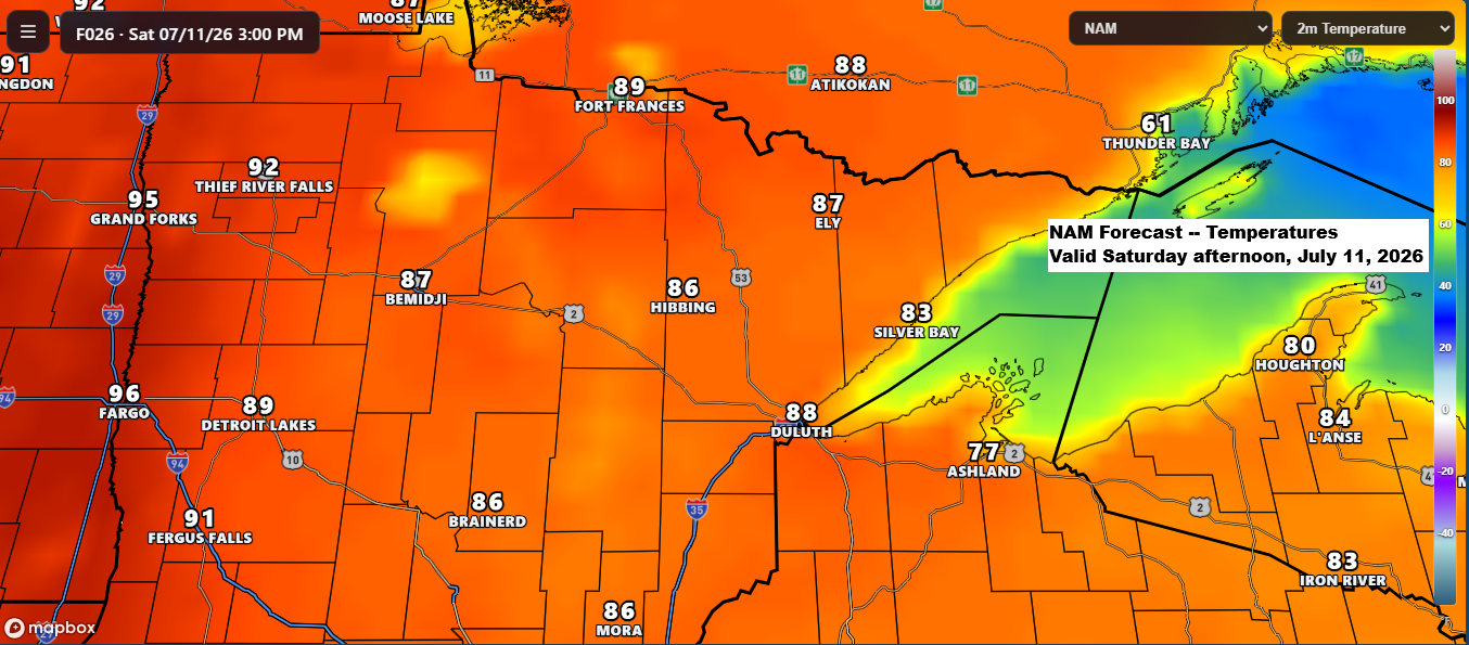
High temperatures are expected to be in the 80s to low 90s on Saturday, then climb to around 88 to 96 degrees on Sunday and Monday, with some spots potentially nearing 100 degrees, especially on Monday.
In the coming days, a large and strengthening ridge of high pressure will build over the northern Plains and upper Midwest. This ridge is expected to peak on Monday, when 500mb heights could climb to around 600 decameters in and around its center.
Here’s a look at the Euro model’s forecasted 500mb heights for Duluth, Minnesota.
- 7 AM Saturday 7/11: 584dam
- 7 AM Sunday 7/12: 590 dam
- 7 AM Monday 7/13: 596dam
- 7 AM Tuesday 7/14: 596 dam
In context, 500mb heights above roughly 594 dam are considered high-end for Duluth, while anything nearing 598–599 dam is exceptional and close to historic for the area.

While it’s expected to be hot across the Northland this weekend and into early next week, the current forecast suggests there won’t be many new record highs. Hibbing and International Falls have the best shot at setting new records between July 11 and 13.
Record high temperatures for July 11th
Brainerd, MN: 103 set in 1936
Ashland, WI: 98 degrees set in 1980
International Falls, MN: 94 set in 1921
Duluth, MN: 92 set in 1936
Hibbing, MN: 89 set in 1970
Record high temperatures for July 12
Ashland, WI: 105 set in 1936
Brainerd, MN: 103 set in 1936
Duluth, MN: 102 set in 1936
International Falls, MN: 96 set in 1921
Hibbing, MN: 91 set in 1969
Record high temperatures for July 13
Duluth, MN: 106 set in 1936
Ashland, WI: 104 set in 1936
Brainerd, MN: 102 set in 1936
International Falls, MN: 93 set in 1983
Hibbing, MN: 92 set in 1983
On Sunday, all of northeast Minnesota and northwest Wisconsin will be under either major (red) or moderate (orange) risk for heat-related impacts.

On Monday, nearly all of northeast Minnesota and northwest Wisconsin will be in the major (red) category for heat-related impacts, with a few areas facing extreme risk (purple).


It’s July, and while heat waves are nothing new for the northern Plains and upper Midwest this time of year, the forecast for July 12–17 is still calling for temperatures about 10–15 degrees above the mid-July average.

Several fires are burning across far northern Minnesota today, with the largest being the Thumb Fire at 100 acres, followed by the Chub Fire, which covered 25 acres as of Friday afternoon, July 10.
Hot, breezy, and dry weather is expected to continue in the fire areas through early next week.


You have to look closely, but a few isolated showers popped up this afternoon in far northern Minnesota and northwest Wisconsin, just south of Lake Superior. Overall, though, the Northland is heading into a dry stretch of weather that should last at least through next Tuesday.
Radar loop ends 6:04 PM CT Friday, July 10, 2026
Leave a Reply