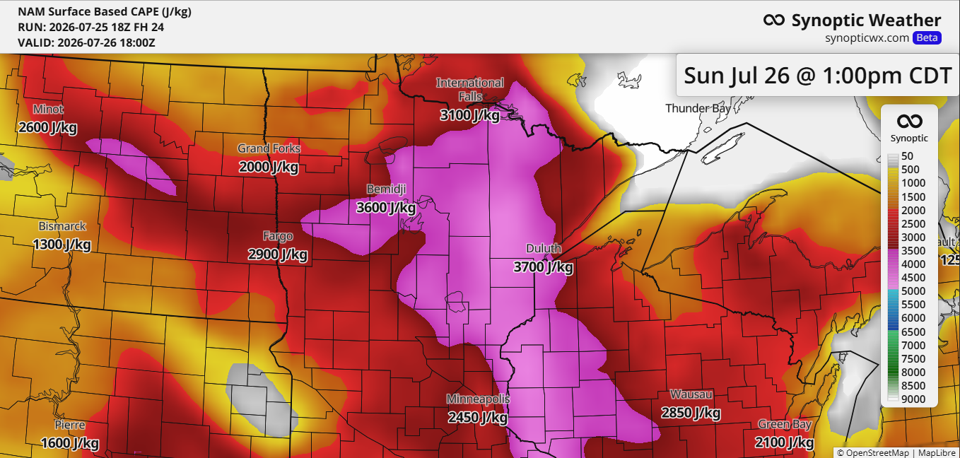
Scattered intense thunderstorms are possible in northeast Minnesota and northwest Wisconsin from Sunday into Sunday night. This threat is driven by strong mid and upper-level winds, high instability (CAPE), and steep mid-level lapse rates between 7 and 8.5 C/km across the Northland. Ample moisture will also be available, with dew points ranging from 65 to 75 degrees, giving storms plenty of fuel.
The uncertainties for Sunday include the timing of potential storms and whether there will be enough forcing for them to develop. A layer of warm air aloft, or the cap, could also play a role, with 700mb temperatures expected to rise to around +10 to +13°C.
If storms develop, they could pack damaging winds of 60 to 80 mph and drop large hail, anywhere from the size of a ping pong ball to a hen’s egg (about 1.5 to 2 inches across).
HRRR model simulated radar forecast valid 7 AM Sunday to 7 AM Monday.
A plume of steep mid-level lapse rates from an elevated mixed layer (EML) over the Rockies and northern Plains will shift into the upper Midwest on Sunday, potentially increasing the risk of stronger storms in the Northland.

The storm threat on Sunday is partly due to a massive ridge stretching over the Rockies and the central and southern Plains, with strong upper-level winds blowing along the far northern edge of this ridge.

Upper-level disturbances moving southeast along the northern edge of a large ridge to the southwest will pass through the upper Midwest tonight and Sunday. These disturbances can be tricky to predict, and the lift they create may be enough to spark thunderstorms. On the loop below, stronger areas of lift are highlighted in yellow, orange, and red.
NAM model 500mb forecast through 10 PM Sunday.

Temperatures closer to the ridge today topped out between 100-110 degrees from parts of the Rockies to the northern Plains.

Highs in our area today were mostly in the 80s. The mix of wildfire smoke creating hazy, filtered sunshine, along with some cloud cover, likely helped keep temperatures from climbing beyond the 80s.
Sunday’s temperature forecast is still uncertain, with factors like cloud cover, wildfire smoke, and the possibility of scattered storms in the mix. Highs could land anywhere from the 70s or 80s to possibly reaching the 90s if the sun sticks around and storm activity stays low.

Rainfall totals through 7 AM Monday aren’t expected to be particularly heavy, with amounts generally ranging from 0.1 to 0.25 inches, though thunderstorms could bring higher totals in localized spots.

Leave a Reply